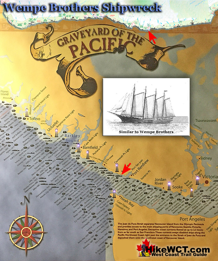
![]() Just as you pass the 49 kilometre mark of the West Coast Trail you will pass the Wempe Brothers shipwreck. A 4 masted, wooden schooner of 681 tons, quite a large sailing vessel for her time. The Wempe Brothers was smashed on the beach here on October 28th, 1903, just a couple kilometres from the Carmanah lighthouse.
Just as you pass the 49 kilometre mark of the West Coast Trail you will pass the Wempe Brothers shipwreck. A 4 masted, wooden schooner of 681 tons, quite a large sailing vessel for her time. The Wempe Brothers was smashed on the beach here on October 28th, 1903, just a couple kilometres from the Carmanah lighthouse.
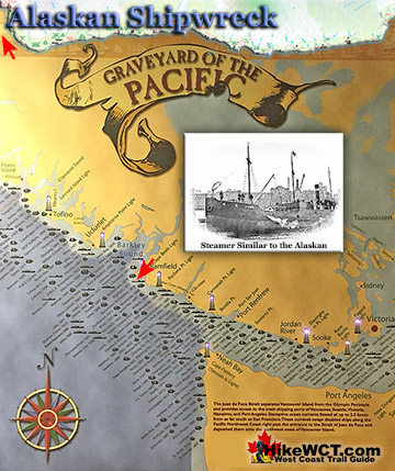
 Alaskan Shipwreck at 4km
- Soquel Shipwreck at 5km
- Sarah Shipwreck at 7km
- Becherdass-Ambiadass Shipwreck at 8km
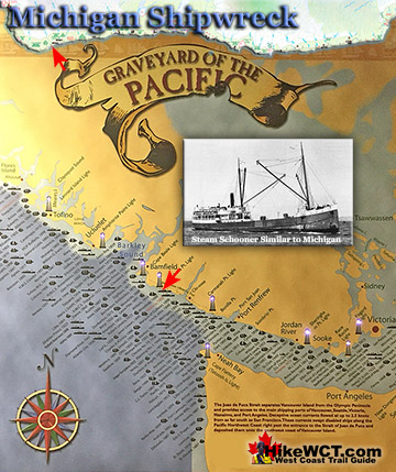
- Michigan Shipwreck at 12km
- Uzbekistan Shipwreck at 13.8km
- Varsity Shipwreck at 17.6km
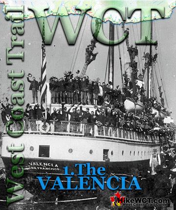
- Valencia Shipwreck at 18.3km
- Janet Cowan Shipwreck at 19km
- Robert Lewers Shipwreck at 20km
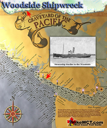
- Woodside Shipwreck at 20.2km
- Uncle John Shipwreck at 26.2km
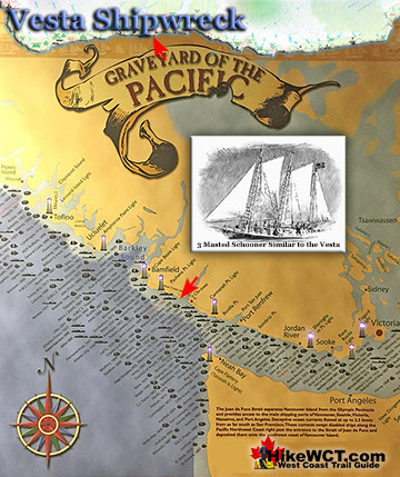
- Vesta Shipwreck at 29km
- Raita Shipwreck at 33km
- Skagit Shipwreck at 34.2km
- Santa Rita Shipwreck at 37km
- Dare Shipwreck at 39km
- Lizzie Marshall Shipwreck at 47km
- Puritan Shipwreck at 48.5km
- Wempe Brothers Shipwreck at 49.4km
- Duchess of Argyle Shipwreck at 58km
- John Marshall Shipwreck at 62.3km
- William Tell Shipwreck at 64.2km
- Revere Shipwreck at 69km
- Cyrus Shipwreck at 75km
The Wempe Brothers was sailing in from San Pedro, California in ballast. She was heading for Puget Sound to pick up lumber when she was claimed by the Graveyard of the Pacific. The crew of 10 experienced very stormy weather as she neared the Cape Flattery lighthouse and entrance to Juan de Fuca Strait. Light winds and thick fog carried them towards the strait, however the fast current pulled them irresistibly north towards the coast of Vancouver Island. The Wempe Brothers was carried so close to Carmanah Point that the lighthouse lights were reported to be reflected on the ships sails and hull. The crew had no idea they were so far out of their intended position and the sudden appearance of a lighthouse must have been terrifying. The wind was dead calm so sailing to safety was not an option. The crew managed to drop two anchors in a desperate effort to halt the ship before colliding with the shore. It was too late, however, as the Wempe Brothers was carried onto the beach at 5am on October 28th, 1903. All the crew managed to quickly escape in lifeboats and rowed out, clear of the breaking waves in order to wait for daylight to allow them to see. When daylight finally broke they rowed back across Juan de Fuca Strait to Neah Bay, Washington. They were then picked up by a tug that took them back to assess the damage. By now the breakers had broken the Wempe Brothers in two and was rapidly smashing it to pieces. Today, you won't spot any remnants of this shipwreck, however, you will be able to get remarkably close if you walk out, at low tide to the end of the point at roughly 49.5 kilometres on the West Coast Trail. You can stand at the edge of the rocky shelf that she smashed against and picture yourself rowing a lifeboat across the strait to the United States from here!

More Shipwrecks Near the Wempe Brothers (KM49)
The Puritan Shipwreck Near KM48.5
![]() The Graveyard of the Pacific is well represented here and you will find two more shipwreck locations in the vicinity of Bonilla Point. The Puritan was a 4 masted schooner just 70 tons lighter than Wempe Brothers, that wrecked here in 1896. The 10 man crew made the same mistake that hundreds of crews before them made. They didn't reckon their course with the notorious, strong current of Juan de Fuca Strait. The current pushed them far northwest of their perceived position. Unable to see due to the thick fog, stormy weather and darkness of night the Puritan was pushed into the rocky Bonilla Point. The record shows that she was wrecked at 5am on November 13, 1896.
The Graveyard of the Pacific is well represented here and you will find two more shipwreck locations in the vicinity of Bonilla Point. The Puritan was a 4 masted schooner just 70 tons lighter than Wempe Brothers, that wrecked here in 1896. The 10 man crew made the same mistake that hundreds of crews before them made. They didn't reckon their course with the notorious, strong current of Juan de Fuca Strait. The current pushed them far northwest of their perceived position. Unable to see due to the thick fog, stormy weather and darkness of night the Puritan was pushed into the rocky Bonilla Point. The record shows that she was wrecked at 5am on November 13, 1896.
Puritan shipwreck continued here...
The Lizzie Marshall Shipwreck Near KM47
![]() On the other side of Bonilla Point at about the 47 kilometre mark of the West Coast Trail you will pass the final resting place of the 430 ton barque, Lizzie Marshall. She wrecked here in February 1884 with no loss of life. On February 7th, 1884, this 434 ton American ship headed out of San Francisco to an unspecified port in British Columbia. Two weeks later she approached Cape Flattery cloaked in a thick fog. Added to that, the wind died and the Lizzie Marshall drifted with the current. Her sails drenched and barely touched by the breeze, she wallowed along for hours until breakers were heard and Bonilla Point lay right in front of them. The crew dropped two anchors and prayed they would hold them off the perilously close rock shelf. The captain launched a lifeboat to row to Neah Bay, 15 miles away, in the hopes of finding a boat to haul them out of danger. Soon the fog cleared and a southwest gale blew in. Straining against the anchors, the Lizzie Marshall held for a while. However on the morning of February 22nd, the anchors began to drag. In a fit of desperation the crew cut the masts and rigging and dumped them overboard. The idea was to reduce the effect of the wind by lowering the ships profile. This had little effect and the wind continued to increase in strength. The anchor chains were straining against the intense weight of the ship and finally snapped. The Lizzie Marshall was swept broadside into the reef with the stern jammed in between a large gap in the rocks. The crew managed to claw their way across the reef to the shore safely. A short time later one of the crew attempted to get back to the ship to retrieve some of his belongings. He drowned in the attempt. Local native arrived on the scene and began scavenging the wreck as the crew watched from the shore. As they scavenged, their boat was smashed against the rocks, leaving them stranded as well. Eventually a tug arrived on the scene to rescue the crew and natives.
On the other side of Bonilla Point at about the 47 kilometre mark of the West Coast Trail you will pass the final resting place of the 430 ton barque, Lizzie Marshall. She wrecked here in February 1884 with no loss of life. On February 7th, 1884, this 434 ton American ship headed out of San Francisco to an unspecified port in British Columbia. Two weeks later she approached Cape Flattery cloaked in a thick fog. Added to that, the wind died and the Lizzie Marshall drifted with the current. Her sails drenched and barely touched by the breeze, she wallowed along for hours until breakers were heard and Bonilla Point lay right in front of them. The crew dropped two anchors and prayed they would hold them off the perilously close rock shelf. The captain launched a lifeboat to row to Neah Bay, 15 miles away, in the hopes of finding a boat to haul them out of danger. Soon the fog cleared and a southwest gale blew in. Straining against the anchors, the Lizzie Marshall held for a while. However on the morning of February 22nd, the anchors began to drag. In a fit of desperation the crew cut the masts and rigging and dumped them overboard. The idea was to reduce the effect of the wind by lowering the ships profile. This had little effect and the wind continued to increase in strength. The anchor chains were straining against the intense weight of the ship and finally snapped. The Lizzie Marshall was swept broadside into the reef with the stern jammed in between a large gap in the rocks. The crew managed to claw their way across the reef to the shore safely. A short time later one of the crew attempted to get back to the ship to retrieve some of his belongings. He drowned in the attempt. Local native arrived on the scene and began scavenging the wreck as the crew watched from the shore. As they scavenged, their boat was smashed against the rocks, leaving them stranded as well. Eventually a tug arrived on the scene to rescue the crew and natives.
Lizzie Marshall shipwreck continued here...
The Duchess of Argyle Shipwreck Near KM58
![]() The Duchess of Argyle met her end at the mouth of Cullite Cove back at the 58 kilometre mark of the West Coast Trail. She was a huge, four masted barque with an iron hull and watertight bulkheads. She was sailing in ballast from San Francisco on October 13th, 1887, bound for Vancouver. She would pick up lumber and sail for Melbourne, Australia. Sailing up the coast from San Francisco, the good weather turned bad on October 16th. For almost two weeks a powerful gale hammered the Duchess of Argyle. When the storm finally let up, Cape Flattery was sighted about 20 miles away. The ship, unable to find wind, floated with the current, inching towards Juan de Fuca Strait. Soon a small tug boat arrived to assist the enormous becalmed ship through the strait. They lowered sails and got the hawser aboard to connect the ships. The captain of the tug quickly realized that his vessel was too small to manage such a huge ship rolling in the seas. Cape Flattery was still about 14 miles distant and concealed by fog much of the time. The Duchess of Argyle wallowed in the current until midnight when a strong eastward gale gripped the ship once more. They sailed for Cape Flattery until the wind died again and on November 1st the fog lifted revealing Cape Flattery just 3 miles away. Suddenly the fog returned again, thicker than ever. They crawled forward slowly hoping for the fog to lift again. The fog didn't let up and at 315pm on November 3rd, breakers were heard...
The Duchess of Argyle met her end at the mouth of Cullite Cove back at the 58 kilometre mark of the West Coast Trail. She was a huge, four masted barque with an iron hull and watertight bulkheads. She was sailing in ballast from San Francisco on October 13th, 1887, bound for Vancouver. She would pick up lumber and sail for Melbourne, Australia. Sailing up the coast from San Francisco, the good weather turned bad on October 16th. For almost two weeks a powerful gale hammered the Duchess of Argyle. When the storm finally let up, Cape Flattery was sighted about 20 miles away. The ship, unable to find wind, floated with the current, inching towards Juan de Fuca Strait. Soon a small tug boat arrived to assist the enormous becalmed ship through the strait. They lowered sails and got the hawser aboard to connect the ships. The captain of the tug quickly realized that his vessel was too small to manage such a huge ship rolling in the seas. Cape Flattery was still about 14 miles distant and concealed by fog much of the time. The Duchess of Argyle wallowed in the current until midnight when a strong eastward gale gripped the ship once more. They sailed for Cape Flattery until the wind died again and on November 1st the fog lifted revealing Cape Flattery just 3 miles away. Suddenly the fog returned again, thicker than ever. They crawled forward slowly hoping for the fog to lift again. The fog didn't let up and at 315pm on November 3rd, breakers were heard...
Duchess of Argyle shipwreck continued here...
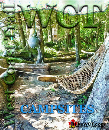
Campsites Near the Wempe Brothers (KM49)
Bonilla Creek Campsite at 48km
![]() There is an excellent campsite just down the beach from where the Wempe Brothers met her end. Bonilla Creek at 48k The Bonilla Creek campsite is easy to miss, as it looks very unassuming from the beach as most hikers pass by. Bonilla Falls, however is nestled against a small cliff at the edge of a suddenly deep forest. And the forest hides a nice little world, somewhat sheltered from the elements. An outhouse sits up at the far end, and several tent clearings stretch to the beach where you find a wonderful hammock cobbled together over the years out of old fishing nets and ropes. A bit surreal in such a remote feeling place, but it is so elaborate that it makes you look around for permanent residents! You won't find any permanent human residents, however, you will encounter some wildlife as there always seems to be a bear or two walking the shoreline between Bonilla Point and Carmanah Creek in the early morning hours.
There is an excellent campsite just down the beach from where the Wempe Brothers met her end. Bonilla Creek at 48k The Bonilla Creek campsite is easy to miss, as it looks very unassuming from the beach as most hikers pass by. Bonilla Falls, however is nestled against a small cliff at the edge of a suddenly deep forest. And the forest hides a nice little world, somewhat sheltered from the elements. An outhouse sits up at the far end, and several tent clearings stretch to the beach where you find a wonderful hammock cobbled together over the years out of old fishing nets and ropes. A bit surreal in such a remote feeling place, but it is so elaborate that it makes you look around for permanent residents! You won't find any permanent human residents, however, you will encounter some wildlife as there always seems to be a bear or two walking the shoreline between Bonilla Point and Carmanah Creek in the early morning hours.
Bonilla Creek Campsite is Gorgeous and Everyone Misses It

The campsite at Bonilla Creek has some beautiful characteristics. First the cute, Bonilla Falls have a perfect little pool to swim in and wash off the days hiking grime. Second, the campsite is quite good with lots of varied places to put up a tent as well as some driftwood structures out on the beach. Third, the sunsets are sensational here. Bright orange, with the narrow islands in the distance topped by improbable looking trees. Added to that, you have a relatively quiet campsite compared to other West Coast Trail campsites.

Bonilla Creek campsite continued here...
Carmanah Creek Campsite at 46km
Just two kilometres past Bonilla Creek(heading north) you come to another very nice West Coast Trail campsite. ![]() Carmanah Creek slowly flows through this wonderfully massive channel that cuts deep into the sand out to the ocean. There is a cable car crossing that connects to the forest on either side of the creek. Most West Coast Trail hikers pass the campsite here without taking a moment to look at the nice beach. Plenty of room for plenty of tents on the wide, sand beach. This is one of the beaches that makes you drop your pack, sit on the warm sand and gaze out at the ocean dumbfounded for minutes at a time. The West Coast Trail is something special! There is no shortage of great spots on the beach to put up your tent. You can even put up your tent along the river on the lovely sandy/rocky bank, though you have to be aware of high tide. Everybody camps at the unimpressive Cribs Creek campsite just 4 kilometres away, leaving Carmanah Creek a serene little hideaway. This is one of the campsites where you will want to stay for days, so you might want to include that in your itinerary!
Carmanah Creek slowly flows through this wonderfully massive channel that cuts deep into the sand out to the ocean. There is a cable car crossing that connects to the forest on either side of the creek. Most West Coast Trail hikers pass the campsite here without taking a moment to look at the nice beach. Plenty of room for plenty of tents on the wide, sand beach. This is one of the beaches that makes you drop your pack, sit on the warm sand and gaze out at the ocean dumbfounded for minutes at a time. The West Coast Trail is something special! There is no shortage of great spots on the beach to put up your tent. You can even put up your tent along the river on the lovely sandy/rocky bank, though you have to be aware of high tide. Everybody camps at the unimpressive Cribs Creek campsite just 4 kilometres away, leaving Carmanah Creek a serene little hideaway. This is one of the campsites where you will want to stay for days, so you might want to include that in your itinerary!
Carmanah Creek Campsite is Never Busy and Incredible


Carmanah Creek campsite continued here...
Walbran Creek Campsite at 53km
Back in the opposite direction from where the Wempe Brothers wrecked at 49.4k, you have another excellent campsite. ![]() Walbran Creek at 53k is home to possibly the best, and most unappreciated campsites on the West Coast Trail. It encapsulates so much that makes the West Coast Trail truly wonderful. The expansive beach which seems purpose built for enjoyability is flanked by scenic cliffs and creek on one side, the pacific ocean on the other, and backed by the emerald coloured Walbran Creek that flows through the jungle valley spanned by a cable car crossing! The cable car crossing is exhilarating. It is a very long one and this one in particular invites you to stop midway and take in the stunning view in either direction. Upstream the view is an emerald coloured creek(though it looks more like a river in size), flanked by a beautifully tangled rainforest. The view in the other direction is of the Pacific Ocean framed by trees on either side. Though this image is pretty, it doesn't reveal the true beauty of the campsite that spills out along the beach, just out of view. For most, this cable car glimpse is the closest they get to the Walbran Creek campsite. Such a shame as they are passing a little piece of West Coast Trail paradise. If you do venture down the short side trail to the campsite, almost entirely on the beach you will be instantly surprised by the beach of weather rounded rocks and maze of driftwood logs. Though a beautiful, sandy beach may be your ideal, a pebble beach is a close second. Clean and tidy, you don't get a sleeping bag full of sand. The driftwood logs along the beach are semi permanent, and have been adjusted over time to create naturally divided clearings. Little, marvelously segregated, sandy patches ideal for tents. You could be 10 metres from your neighbour and the wall of driftwood logs blocks the sight and sound you might get from others. So you have privacy, which you may not need as Walbran Creek is one of the less visited campsites on the West Coast Trail and where you may find dozens of tents at Tsusiat Falls or Camper Bay. At Walbran Creek you may encounter nobody!
Walbran Creek at 53k is home to possibly the best, and most unappreciated campsites on the West Coast Trail. It encapsulates so much that makes the West Coast Trail truly wonderful. The expansive beach which seems purpose built for enjoyability is flanked by scenic cliffs and creek on one side, the pacific ocean on the other, and backed by the emerald coloured Walbran Creek that flows through the jungle valley spanned by a cable car crossing! The cable car crossing is exhilarating. It is a very long one and this one in particular invites you to stop midway and take in the stunning view in either direction. Upstream the view is an emerald coloured creek(though it looks more like a river in size), flanked by a beautifully tangled rainforest. The view in the other direction is of the Pacific Ocean framed by trees on either side. Though this image is pretty, it doesn't reveal the true beauty of the campsite that spills out along the beach, just out of view. For most, this cable car glimpse is the closest they get to the Walbran Creek campsite. Such a shame as they are passing a little piece of West Coast Trail paradise. If you do venture down the short side trail to the campsite, almost entirely on the beach you will be instantly surprised by the beach of weather rounded rocks and maze of driftwood logs. Though a beautiful, sandy beach may be your ideal, a pebble beach is a close second. Clean and tidy, you don't get a sleeping bag full of sand. The driftwood logs along the beach are semi permanent, and have been adjusted over time to create naturally divided clearings. Little, marvelously segregated, sandy patches ideal for tents. You could be 10 metres from your neighbour and the wall of driftwood logs blocks the sight and sound you might get from others. So you have privacy, which you may not need as Walbran Creek is one of the less visited campsites on the West Coast Trail and where you may find dozens of tents at Tsusiat Falls or Camper Bay. At Walbran Creek you may encounter nobody!
Walbran Creek Campsite is Amazing


Walbran Creek campsite continued here...
Cullite Cove Campsite at 58km
![]() Just another 5 kilometres south on the West Coast Trail from Walbran Creek, you come to Cullite Cove at 58k. Yet another, excellent and often missed highlight of the West Coast Trail. It has almost everything you could want from a wild, WCT campsite. A lovely wooded area with clearings for tents and campfires. Stunning views all around. A terrific, rocky beach, beautifully hemmed in by towering cliffs on either side. Cullite Creek pours into the cove, making for a stunning, albeit freezing swim into the surf. Cullite Cove is a close to perfect as a campsite can get. Cullite Creek is beautiful, crystal clear green, big and slow moving into Cullite Cove, a picture perfect beach hemmed in by majestic cliffs on both sides. Just off the beach, several campsites are laid out, hidden in the trees. Your first thought on seeing this site is to want to stay for a week. The campsite here is often very quiet as everybody seems to camp at Camper Bay just 4 kilometres away and doesn't even drop down the short detour off the main trail to Cullite Cove.
Just another 5 kilometres south on the West Coast Trail from Walbran Creek, you come to Cullite Cove at 58k. Yet another, excellent and often missed highlight of the West Coast Trail. It has almost everything you could want from a wild, WCT campsite. A lovely wooded area with clearings for tents and campfires. Stunning views all around. A terrific, rocky beach, beautifully hemmed in by towering cliffs on either side. Cullite Creek pours into the cove, making for a stunning, albeit freezing swim into the surf. Cullite Cove is a close to perfect as a campsite can get. Cullite Creek is beautiful, crystal clear green, big and slow moving into Cullite Cove, a picture perfect beach hemmed in by majestic cliffs on both sides. Just off the beach, several campsites are laid out, hidden in the trees. Your first thought on seeing this site is to want to stay for a week. The campsite here is often very quiet as everybody seems to camp at Camper Bay just 4 kilometres away and doesn't even drop down the short detour off the main trail to Cullite Cove.
Cullite Cove Campsite is Incredible and Most Skip It!

Cullite Cove campsite continued here...
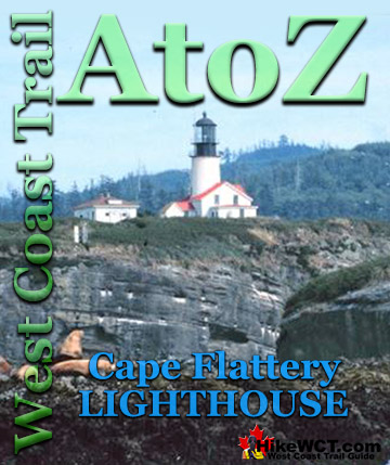
West Coast Trail A to Z
West Coast Trail Shipwrecks
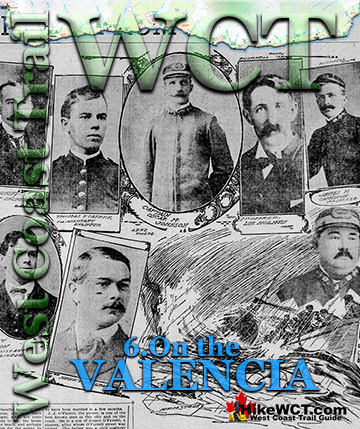
The Valencia Disaster

West Coast Trail Guide

Explore BC Hiking Destinations!
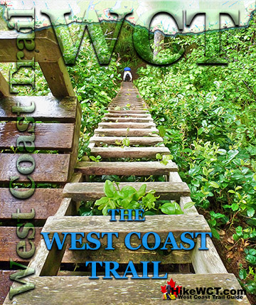
The West Coast Trail
Victoria Hiking Trails

Clayoquot Hiking Trails
Whistler Hiking Trails

Squamish Hiking Trails

Vancouver Hiking Trails