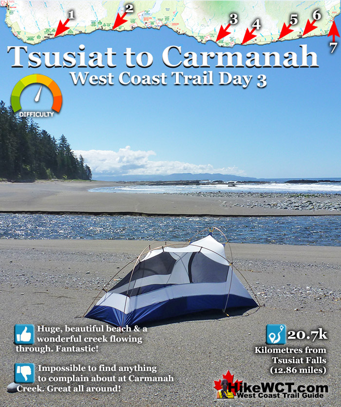
![]() The gap between official West Coast Trail campsites is quite large after Tsusiat Falls at 25km. The next campsite heading south is the crowded and ugly one at Cribs Creek at 41.5km, followed by Carmanah Creek at 46km. Tsusiat to Carmanah is a fairly long distance at 21km, but if you camp at Cribs Creek like everyone else, you only reduce the distance by only 5km. The 5km is almost entirely beach as well which is fairly relaxing.
The gap between official West Coast Trail campsites is quite large after Tsusiat Falls at 25km. The next campsite heading south is the crowded and ugly one at Cribs Creek at 41.5km, followed by Carmanah Creek at 46km. Tsusiat to Carmanah is a fairly long distance at 21km, but if you camp at Cribs Creek like everyone else, you only reduce the distance by only 5km. The 5km is almost entirely beach as well which is fairly relaxing.
 Tsusiat Falls is a stunning place to start your day
- Eat breakfast and watch for whales passing by
- Hole in the Wall is a gorgeous rock formation to see
- The Crab Shack serves crab and chicken dinners
- Much of your days hiking is easy and scenic
- Carmanah Lighthouse can be visited(grounds only)
- Chez Monique's sells meals & drinks
- Carmanah Creek campsite is wonderful & quiet
- Beautiful, long sandy beaches are frequent
 Massive 17 kilometre gap between campsites
Hike the West Coast Trail
![]() Prologue
Prologue ![]() 1: The West Coast Trail
1: The West Coast Trail ![]() 2: When to Hike & Fees
2: When to Hike & Fees ![]() 3: Trailheads
3: Trailheads ![]() 4: Getting There
4: Getting There ![]() 5: Considerations
5: Considerations ![]() 6: Campsites
6: Campsites ![]() 7: Shipwrecks
7: Shipwrecks ![]() 8: Routes
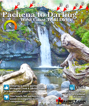
8: Routes ![]() Day 1 Pachena to Darling
Day 1 Pachena to Darling ![]() Day 2 Darling to Tsusiat
Day 2 Darling to Tsusiat ![]() Day 3 Tsusiat to Carmanah
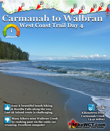
Day 3 Tsusiat to Carmanah ![]() Day 4 Carmanah to Walbran
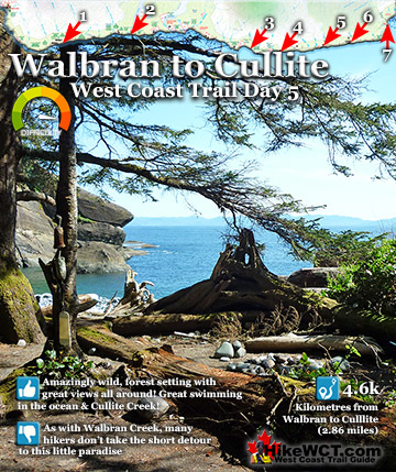
Day 4 Carmanah to Walbran ![]() Day 5 Walbran to Cullite
Day 5 Walbran to Cullite ![]() Day 6 Cullite to Camper
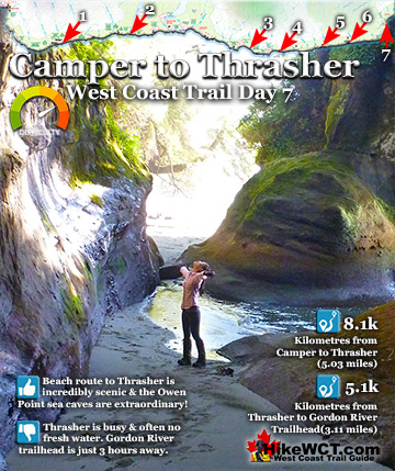
Day 6 Cullite to Camper ![]() Day 7 Camper to Thrasher
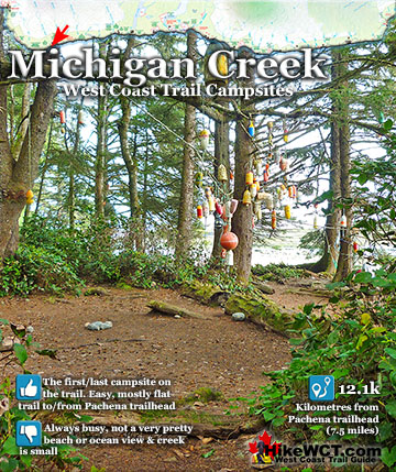
Day 7 Camper to Thrasher ![]() Michigan Creek at 12k
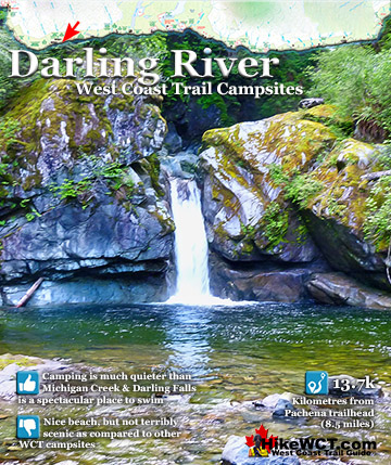
Michigan Creek at 12k ![]() Darling River at 14k
Darling River at 14k ![]() Orange Juice Creek at 15k
Orange Juice Creek at 15k ![]() Tsocowis Creek at 16.5k
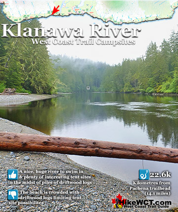
Tsocowis Creek at 16.5k ![]() Klanawa River at 23k
Klanawa River at 23k ![]() Tsusiat Falls at 25k
Tsusiat Falls at 25k ![]() Cribs Creek at 42k
Cribs Creek at 42k ![]() Carmanah Creek at 46k
Carmanah Creek at 46k ![]() Bonilla Creek at 48k
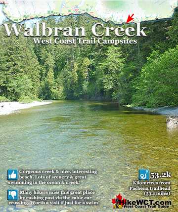
Bonilla Creek at 48k ![]() Walbran Creek at 53k
Walbran Creek at 53k ![]() Cullite Cove at 58k
Cullite Cove at 58k ![]() Camper Bay at 62k
Camper Bay at 62k ![]() Thrasher Cove at 70k
Thrasher Cove at 70k
The hike from Tsusiat begins with a choice of walking along the beach or through the forest. The forest route is pretty challenging and the beach route is pretty relaxing. You climb into the forest at 29.2km and hike 3km of challenging jungle hiking to arrive at the Nitinat Narrows crossing. The inland trail is fairly easy as you pass through two First Nations regions, Whyac and Clo-oose. You then start a gorgeous section of beach from 36km to 38km. The beach section here is very nice as it is wide, sandy and goes on and on. The beach hiking is very relaxing and there is a detour inland just past the 38k mark, then you again have a choice of inland, forest route or the lovely beach route. At 40km you come to Dare Beach, or if you take the forest route, you will see it from high above on the bridge crossing Dare Creek. Dare Beach is an unofficial campsite along the West Coast Trail. You are allowed to camp there, but it not on the maps for some reason. Dare Beach is an excellent option to camp if you don't want to continue six more kilometres to Carmanah Creek at 46km. If you do continue on you will reach the campsite at Cribs Creek at 41.5km. Cribs Creek is a shallow creek that passes alongside the beach campsite to the ocean. The Cribs Creek campsite should be avoided if possible because it is always busy and the beach is not very pretty. Because the enormous gap to the Tsusiat Falls campsite heading north, everyone camps at Cribs and Tsusiat.
Day 3: Tsusiat to Carmanah on the West Coast Trail
The campsite at Tsusiat stretches far along the beach, so it can accommodate a tremendous number of campers. At Cribs Creek, however, the beach is narrow along the shore and hemmed in by an uninviting rocky shelf at the water. If you have the energy and desire, you could hike an extra 3.7k to the stunningly beautiful campsite at Carmanah Creek. Relatively few people camp here because everyone camps at Cribs Creek. Carmanah Creek is very pretty and the wonderful sandy beach extends in both directions as far as the eye can see. If you are keen to eat at Chez Monique's, you will be just a 20 minute walk away. Chez Monique's is a beach restaurant on First Nations reserve land and sells burgers, beer and quite a lot more.

Tsusiat Falls Campsite at 25km
![]() Tsusiat Falls is one of the most popular attractions on the trail with its dramatically wide and beautifully picturesque appearance. You will find Tsusiat Falls near the base of an extraordinary array of ladders extending hundreds of metres up into the trees. Tsusiat Falls pours over an abrupt and wide cliff onto the sandy beach. The force of the water has dug out quite a large pool that flows in an ever changing channel through the sand to the ocean. It is quite common to see whales passing in the distance from the beach at Tsusiat. The beach is raised up a few metres from the ocean and affords you a better vantage point over the ocean than you get elsewhere. Tsusiat Falls campsite is wide and extends as far as you want to go down the beach. As everyone has seen pictures of it, everyone aims for it to spend the night. If you don't mind crowds then you'll love it. If you don't like crowds, you may have trouble finding a serene corner to camp. If you really want to find serenity, you might try camping at the far end of the beach where you will find quite a large sea cave. If you love waking up to whales in the distance and the beautiful roar of waterfalls nearby, then you will find that at Tsusiat. The campsite is well designed for crowds though as the hundreds of driftwood logs on the beach have fashioned partitioned areas randomly, where some sort of organized privacy exists.
Tsusiat Falls is one of the most popular attractions on the trail with its dramatically wide and beautifully picturesque appearance. You will find Tsusiat Falls near the base of an extraordinary array of ladders extending hundreds of metres up into the trees. Tsusiat Falls pours over an abrupt and wide cliff onto the sandy beach. The force of the water has dug out quite a large pool that flows in an ever changing channel through the sand to the ocean. It is quite common to see whales passing in the distance from the beach at Tsusiat. The beach is raised up a few metres from the ocean and affords you a better vantage point over the ocean than you get elsewhere. Tsusiat Falls campsite is wide and extends as far as you want to go down the beach. As everyone has seen pictures of it, everyone aims for it to spend the night. If you don't mind crowds then you'll love it. If you don't like crowds, you may have trouble finding a serene corner to camp. If you really want to find serenity, you might try camping at the far end of the beach where you will find quite a large sea cave. If you love waking up to whales in the distance and the beautiful roar of waterfalls nearby, then you will find that at Tsusiat. The campsite is well designed for crowds though as the hundreds of driftwood logs on the beach have fashioned partitioned areas randomly, where some sort of organized privacy exists.

Leaving Tsusiat Falls
Leaving Tsusiat Falls is hard to do. It is possibly the nicest place to swim on the West Coast Trail. You can even duck behind the falls.

Beach Route or Forest Route Up the Ladders
You have a choice of hiking along the beach or up the ladders and through the forest. The forest route is very challenging and the beach route is quite beautiful.

Leaving Tsusiat Beach Toward Hole in the Wall
Tsusiat Beach is beautiful to walk along with jagged reefs offshore to your right and steep sandstone cliffs on your left. Occasionally you spot small caves in the cliffs where the waves have undercut the cliffs a couple metres.

Uncle John Shipwreck at 26k
![]() The Uncle John was a 138 foot, three masted barkentine of 314 tons. Built in Eureka, California in 1881 and wrecked one kilometre east of Tsusiat Falls on the West Coast Trail. She was inbound in ballast from Hololulu, heading to Port Townsend. Owing to awful weather and heavy seas, the crew was unable to obtain any sights. Upon hearing breakers, she slowed and drifted into "an immense flat rock", which the ship became lodged against. Unable to launch a boat, the crew was forced to spend the night on the unmovable ship. When daylight finally arrived, the crew was able to make their escape to shore. The Uncle John continued to get pounded against the rock shelf until she was breaking apart. Her final resting place on the Graveyard of the Pacific is just down the beach from Hole In the Wall on the West Coast Trail.
The Uncle John was a 138 foot, three masted barkentine of 314 tons. Built in Eureka, California in 1881 and wrecked one kilometre east of Tsusiat Falls on the West Coast Trail. She was inbound in ballast from Hololulu, heading to Port Townsend. Owing to awful weather and heavy seas, the crew was unable to obtain any sights. Upon hearing breakers, she slowed and drifted into "an immense flat rock", which the ship became lodged against. Unable to launch a boat, the crew was forced to spend the night on the unmovable ship. When daylight finally arrived, the crew was able to make their escape to shore. The Uncle John continued to get pounded against the rock shelf until she was breaking apart. Her final resting place on the Graveyard of the Pacific is just down the beach from Hole In the Wall on the West Coast Trail.

In the picture below you can barely see Hole in the Wall in the distance, far left. The Uncle John wrecked directly out to sea from where the picture taker was standing, possible hit that reef in the right side of the picture.

Interesting Rock Wall Near Hole in the Wall
Just before Hole in the Wall you come to this interesting cliff jutting out from the forest. A strange fridge shaped rock juts out of the sand from the base of the cliff.

It looks as if these giant pillars of rock were tossed here as they look strangely out of place.

Animal Tracks on the Beach
Big paw prints disappear around the pillar.

Tsusiat Point Hole in the Wall at 27km
Hole in the Wall is a stunning rock formation that resulted from uneven water erosion cutting a hole through this otherwise rock wall. A faint trail on its south side allows you to hike up and cross the natural bridge, affording you great views all around. You do have to be careful hiking trough Hole in the Wall as high tides may block your way and you will be forced to detour via the inland route.

Hole in the wall is one of the best and most well known sights on the West Coast Trail. The relentless pounding of waves up and down the coast has carved several interesting caves and rock features along the trail, but Hole in the Wall is definitely the most dramatically beautiful.


On Top of Hole in the Wall at Tsusiat Point
It is easy to climb up to the top of Hole in the Wall to get a completely different perspective.


Vesta Shipwreck Near 29km
![]() At about 29 kilometres on the West Coast Trail you will pass the Vesta shipwreck. This 3 masted schooner of 286 tons was wrecked here on November 10th, 1897. This 128 foot long sailing ship was primarily used to ship lumber to California. The Vesta was inbound from California in ballast to Port Blakely Mills on Bainbridge Island, Washington. The Vesta wrecked at 430am on the 10th of November and was carried so high on the beach as to find her masts in the trees. She had overrun her position due to stormy, foggy weather and the unaccounted for current that brought so many ships to a tragic end in the Graveyard of the Pacific. All of the Vesta's crew of 8 men survived and were able to row to safety and rescue once the storm eased enough to safely travel. The Vesta, owing to its resting place high on the beach, remained there for several years.
At about 29 kilometres on the West Coast Trail you will pass the Vesta shipwreck. This 3 masted schooner of 286 tons was wrecked here on November 10th, 1897. This 128 foot long sailing ship was primarily used to ship lumber to California. The Vesta was inbound from California in ballast to Port Blakely Mills on Bainbridge Island, Washington. The Vesta wrecked at 430am on the 10th of November and was carried so high on the beach as to find her masts in the trees. She had overrun her position due to stormy, foggy weather and the unaccounted for current that brought so many ships to a tragic end in the Graveyard of the Pacific. All of the Vesta's crew of 8 men survived and were able to row to safety and rescue once the storm eased enough to safely travel. The Vesta, owing to its resting place high on the beach, remained there for several years.
Often used by lineman seeking shelter, she was often noted by passing ships and used as a landmark. Sadly, someone burned it in order to salvage the metal fastenings. Some metal parts of the Vesta can still be found today on the spot where she rested for so long. One of her anchors still lies buried in the sand and revealed occasionally by winter storms. The picture below is of the beach the Vesta was thrown onto and remained for several years.

Amazing View from the Forest Trail Near 29km

Ditidaht Nation Comfort Camping Site at 30km

Hilarious Creek Crossing Near 30km

Beautiful Beach at KM31
This incredible beach appears from the cliffs high above near KM31. This beach perfectly represents the West Coast Trail. A wide, beautifully sandy beach, backed by a steep cliff. Hidden feeling and serene, but at the same time hostile looking with black pinnacles of rock jutting out of the ocean. Another wonderful feature of West Coast Trail beaches is you never see anyone on them. The trail is so long and there are countless beaches, so with the exception of campsite beaches you almost never see anyone else. Along the West Coast Trail every time you find the best beach, another better beach appears a few hours later.

More Boardwalk Destruction Near 31km

More Amazing Views at 31km

Amazing Views Along the Clifftop Trail

Nitinaht Narrows Boat Crossing at 32.2km
At 32.2km you come to an abrupt dead end at Nitinaht Narrows. There is a very small and absurdly decrepit pier where you wait for the ferry to pick you up. If they don't see or hear you on the other side, you may have to wait a while.

Nitinaht Narrows Crab Shack
Once you are ferried across you arrive at a much larger pier that is home to the Crab Shack. A small cafeteria that offers excellent chicken and potato meals as well as live crab dinners. They actually pull the crabs up from the side of the wharf then cook it right in front of you if you want. Many West Coast Trail hikers find Chez Monique's further south to be an affront to the serenity of the trail. The Crab Shack, by contrast, seems to fit nicely and only seems to add to the fun of the West Coast Trail. If you are cold and wet from the trail, you can sit next to their lovely wood stove and chat with the always friendly and interesting locals.

Raita Shipwreck at 33km
![]() The Raita shipwreck is located off the reefs at about the 33 kilometre mark of the West Coast Trail. Located just offshore and most remnants of this wreck are hidden under the waves. Some of the hull timbers can still be seen by the determined, just down from the river bed near Whyac Point. This section of the West Coast Trail is quite far inland, away from the coast, so you won't likely even get to look over the sea where she met her end. The Raita is just off the rocks near Whyac Point. Whyac Point is just down from the Nitinaht Narrows ferry crossing on the West Coast Trail. The Raita was a 3 masted schooner of 309 tons, built in California in 1890(originally the Raita was named Lucy). The Raita was a French registered ship of of Papete, French Polynesia. She was loaded with lumber from Port Gamble, Washington heading to deliver it to Tahiti. Shortly after setting sail, she began taking on water. The strong winds and current overpowered the Raita and she was forced perilously close to Vancouver Island. In a desperate attempt to regain control, the crew began dumping their cargo into the sea and dropped her anchor. The winds picked up and snapped the anchor chain.
The Raita shipwreck is located off the reefs at about the 33 kilometre mark of the West Coast Trail. Located just offshore and most remnants of this wreck are hidden under the waves. Some of the hull timbers can still be seen by the determined, just down from the river bed near Whyac Point. This section of the West Coast Trail is quite far inland, away from the coast, so you won't likely even get to look over the sea where she met her end. The Raita is just off the rocks near Whyac Point. Whyac Point is just down from the Nitinaht Narrows ferry crossing on the West Coast Trail. The Raita was a 3 masted schooner of 309 tons, built in California in 1890(originally the Raita was named Lucy). The Raita was a French registered ship of of Papete, French Polynesia. She was loaded with lumber from Port Gamble, Washington heading to deliver it to Tahiti. Shortly after setting sail, she began taking on water. The strong winds and current overpowered the Raita and she was forced perilously close to Vancouver Island. In a desperate attempt to regain control, the crew began dumping their cargo into the sea and dropped her anchor. The winds picked up and snapped the anchor chain.

The crew seeing the rocky shoreline coming near, launched a lifeboat and escaped. They managed to row safely to the Carmanah Lighthouse and were soon picked up by a passing CPR steamship. The Raita was bashed into the shore at Whyac Point, which at the time was known as Mission Point. At low tide she was high and dry on the rocks, completely out of the water. She was wrecked here on January 18th, 1925. Some of the old ship's hull timbers can still be seen today, a century later!

Skagit Shipwreck at 34.2k
![]() The Skagit, a 3 masted barkentine of 506 tons was wrecked on the reef in front of Clo-oose on what is now the West Coast Trail. This 156 foot ship was built in Port Ludlow, Washington in 1883 and was primarily used to ship lumber down the coast to San Francisco. The Skagit was sailing in from San Francisco in ballast to Port Gamble, Washington to load lumber. The crew ran into a storm and massively misread her position. The crew sighted the Cape Flattery Lighthouse and believed it to be the light from the Umatilla lighthouse. The storm drove her on to the reef at 4am on October 25th, 1906. The impact of the ship hitting the rocks was so powerful that it killed the captain and cook. The remaining 8 crew members escaped by scrambling over the bow at daybreak and clawing their way to shore. They found help and shelter at Clo-oose and later brought down to Victoria. Today you will almost trip over one of the Skagit's anchors where it lays on the beach in the same spot as it has for a century. You will see it just past the Nitinaht Narrows ferry crossing, after you hike through the forest and emerge on the beach. The adventurous and determined may be able to find more remnants of the Skagit down at the foot of the reef, just below the low tide level.
The Skagit, a 3 masted barkentine of 506 tons was wrecked on the reef in front of Clo-oose on what is now the West Coast Trail. This 156 foot ship was built in Port Ludlow, Washington in 1883 and was primarily used to ship lumber down the coast to San Francisco. The Skagit was sailing in from San Francisco in ballast to Port Gamble, Washington to load lumber. The crew ran into a storm and massively misread her position. The crew sighted the Cape Flattery Lighthouse and believed it to be the light from the Umatilla lighthouse. The storm drove her on to the reef at 4am on October 25th, 1906. The impact of the ship hitting the rocks was so powerful that it killed the captain and cook. The remaining 8 crew members escaped by scrambling over the bow at daybreak and clawing their way to shore. They found help and shelter at Clo-oose and later brought down to Victoria. Today you will almost trip over one of the Skagit's anchors where it lays on the beach in the same spot as it has for a century. You will see it just past the Nitinaht Narrows ferry crossing, after you hike through the forest and emerge on the beach. The adventurous and determined may be able to find more remnants of the Skagit down at the foot of the reef, just below the low tide level.
Cheewhat River Crossing Near 35km

Beautiful Cheewhat Beach at 37km

Santa Rita Shipwreck at 37k
![]() At the 37 kilometre mark on the West Coast Trail you will pass the Santa Rita, a 100 year old shipwreck hidden under the waves. The Santa Rita was a steel steam schooner, built in San Francisco in 1913. On February 15th, 1923 at 520am, this 235 foot long, 1600 ton ship collided head on with the the small island reef just a few hundred metres from the beach. The Santa Rita was sailing in from San Pedro, California, in ballast for a port in the Puget Sound. In stormy weather and blindly navigating in poor visibility, the Carmanah light was mistaken for the Cape Flattery Lighthouse on Tatoosh Island. The Carmanah Lighthouse is along the West Coast Trail and the Cape Flattery Lighthouse is across Juan de Fuca Strait in the United States! The crew turned into what they thought was Juan de Fuca Strait and keeping the Cape Flattery Lighthouse on their right. Unfortunately they were about 20 kilometres north of what they thought, and were in fact keeping the Carmanah Lighthouse to their right and sailing directly at Vancouver Island. At 520am on February 15th, 1923 the Santa Rita collided head on into a small offshore reef just a few hundred metres from the West Coast Trail.
At the 37 kilometre mark on the West Coast Trail you will pass the Santa Rita, a 100 year old shipwreck hidden under the waves. The Santa Rita was a steel steam schooner, built in San Francisco in 1913. On February 15th, 1923 at 520am, this 235 foot long, 1600 ton ship collided head on with the the small island reef just a few hundred metres from the beach. The Santa Rita was sailing in from San Pedro, California, in ballast for a port in the Puget Sound. In stormy weather and blindly navigating in poor visibility, the Carmanah light was mistaken for the Cape Flattery Lighthouse on Tatoosh Island. The Carmanah Lighthouse is along the West Coast Trail and the Cape Flattery Lighthouse is across Juan de Fuca Strait in the United States! The crew turned into what they thought was Juan de Fuca Strait and keeping the Cape Flattery Lighthouse on their right. Unfortunately they were about 20 kilometres north of what they thought, and were in fact keeping the Carmanah Lighthouse to their right and sailing directly at Vancouver Island. At 520am on February 15th, 1923 the Santa Rita collided head on into a small offshore reef just a few hundred metres from the West Coast Trail.

The large ship, must have been sailing at quite a speed owing to the crew's reckoning that they were entering Juan de Fuca Strait. The sudden impact must have been horrific, loud, and completely unwarned. In the next few hours the entire crew of 30 escaped the wreck via breeches buoy. A breeches buoy is a rope based rescue system where a line runs from the ship to the shore and survivors ride in a flotation ring and leg harness.
Dare Shipwreck Near 39k
![]() You will pass the Dare shipwreck at the 39 kilometre mark of the West Coast Trail. The Graveyard of the Pacific claimed this 3 masted, 269 ton schooner on December 23rd, 1890. The Dare sailed out of San Francisco in ballast for Tacoma to take on a load of lumber. In the middle of the winter, stormy season along this coast, the Dare was caught in a typically brutal storm. The crew fought the high winds and tumultuous seas driving them towards the unforgiving shore of Vancouver Island. The Dare was smashed on the rock shore just three kilometres west of Carmanah Point. The crew, unhurt from the impact of the ship was able to get ashore relatively easily. Luckily for the crew they were soon met by Indians who resided just down the beach. The good folks that ferry West Coast Trail hikers across Nitinaht Narrows are descendants of the rescuers of the crew of the Dare. They were transported to Victoria by canoe by the natives. Their ship was left smashed on the rocks and what could be salvaged or looted was taken away. Today there are no visible remnants of the Dare shipwreck except one marvellous reminder of this brutal coastline, the ship's anchor.
You will pass the Dare shipwreck at the 39 kilometre mark of the West Coast Trail. The Graveyard of the Pacific claimed this 3 masted, 269 ton schooner on December 23rd, 1890. The Dare sailed out of San Francisco in ballast for Tacoma to take on a load of lumber. In the middle of the winter, stormy season along this coast, the Dare was caught in a typically brutal storm. The crew fought the high winds and tumultuous seas driving them towards the unforgiving shore of Vancouver Island. The Dare was smashed on the rock shore just three kilometres west of Carmanah Point. The crew, unhurt from the impact of the ship was able to get ashore relatively easily. Luckily for the crew they were soon met by Indians who resided just down the beach. The good folks that ferry West Coast Trail hikers across Nitinaht Narrows are descendants of the rescuers of the crew of the Dare. They were transported to Victoria by canoe by the natives. Their ship was left smashed on the rocks and what could be salvaged or looted was taken away. Today there are no visible remnants of the Dare shipwreck except one marvellous reminder of this brutal coastline, the ship's anchor.

The ship crashed onto the rocks quite a distance from the present location of the anchor. However with no other shipwreck contenders in the area, the anchor West Coast Trail hikers stumble past here is almost certainly the anchor from the Dare. You will see it just past the 38 kilometre mark of the trail laying on the rocks in plain view. Dare Point begins just as you pass the anchor(if hiking from the Pachena trailhead). Further along you will come to Dare Beach, a nice, though narrow patch of beach in an area almost entirely rocky, unforgiving coastline.
Dare Beach Near 39km


Mud and Views at 40km


Ladder Down to Cribs Creek


Cribs Creek Campsite at 41.5km
![]() Cribs Creek at 41.5km is a nice, clean, and surprisingly emerald coloured creek that flows through the beach campsites. That's about the only nice part about the campsite. The beach is not great, it smells of ageing seaweed, the sandy beach has patches of grass and bushes that give it a messy feel. Unlike many other beaches on the West Coast Trail where you have long sandy beaches carved out by the ocean in giant arcs. At Cribs Creek, you find an irregular and not very attractive beach setting. Still, a nice atmosphere can be created. A lively campfire and a West Coast Trail sunset turns this mediocre beach into decent place to get some rest. Certainly the biggest drawback to Cribs Creek is how busy it always is. Owing to its great distance to the next campsite to the north, Tsusiat Falls, everyone seems to camp here. And they camp here after quite a long day of hiking.
Cribs Creek at 41.5km is a nice, clean, and surprisingly emerald coloured creek that flows through the beach campsites. That's about the only nice part about the campsite. The beach is not great, it smells of ageing seaweed, the sandy beach has patches of grass and bushes that give it a messy feel. Unlike many other beaches on the West Coast Trail where you have long sandy beaches carved out by the ocean in giant arcs. At Cribs Creek, you find an irregular and not very attractive beach setting. Still, a nice atmosphere can be created. A lively campfire and a West Coast Trail sunset turns this mediocre beach into decent place to get some rest. Certainly the biggest drawback to Cribs Creek is how busy it always is. Owing to its great distance to the next campsite to the north, Tsusiat Falls, everyone seems to camp here. And they camp here after quite a long day of hiking.

Unlike Tsusiat Falls campers, who tend to marvel at the ocean view or stunning waterfalls, at Cribs Creek you find campers busy and focused on camping and cooking. Skipping Cribs Creek as a campsite is recommended.


Beautiful Beach Beyond Cribs Creek at 42km

Carmanah Point Lighthouse at 44km
![]() Carmanah Point was originally named Bonilla Point by Manuel Quimper in 1790. In 1846 Admiralty surveyors mistakenly placed Bonilla Point at the next point eastward and the mistake became permanent with the naming of the actual Bonilla Point, Carmanah Point. In 1890 construction on a new lighthouse for Bonilla Point began with a large supply drop. Due to heavy fog, the construction materials were accidentally placed on Carmanah Point. Due to the time and effort required to correct this mistake, it was decided to build the lighthouse on Carmanah Point. The light towers 173 feet above the high water mark and can be seen for over 30 kilometres! Visitors are welcome to tour the grounds and take in the marvellous view.
Carmanah Point was originally named Bonilla Point by Manuel Quimper in 1790. In 1846 Admiralty surveyors mistakenly placed Bonilla Point at the next point eastward and the mistake became permanent with the naming of the actual Bonilla Point, Carmanah Point. In 1890 construction on a new lighthouse for Bonilla Point began with a large supply drop. Due to heavy fog, the construction materials were accidentally placed on Carmanah Point. Due to the time and effort required to correct this mistake, it was decided to build the lighthouse on Carmanah Point. The light towers 173 feet above the high water mark and can be seen for over 30 kilometres! Visitors are welcome to tour the grounds and take in the marvellous view.

Chez Monique's at 45km
Chez Monique's is along the beach between the lighthouse and Carmanah Creek. There you will find a restaurant along the beach with burgers and drinks. Seems a bit strange to encounter a restaurant in the middle of the West Coast Trail, but it has been here for years and will likely remain. For some, Chez Monique's is a highlight of the trail, for others it is an annoying bit of civilisation in the midst of the wild beauty of the West Coast of Vancouver Island. Monique recently passed away, however the restaurant is still in operation.

Carmanah Creek Campsite at 46km
![]() Carmanah Creek slowly flows through this wonderfully massive channel that cuts deep into the sand out to the ocean. There is a cable car crossing that connects to the forest on either side of the creek. Most West Coast Trail hikers pass the campsite here without taking a moment to look at the nice beach. Plenty of room for plenty of tents on the wide, sand beach. This is one of the beaches that makes you drop your pack, sit on the warm sand and gaze out at the ocean dumbfounded for minutes at a time. The West Coast Trail is something special! There is no shortage of great spots on the beach to put up your tent. You can even put up your tent along the river on the lovely sandy/rocky bank. Everybody camps at the unimpressive Cribs Creek campsite just 4 kilometres away, leaving Carmanah Creek a serene little hideaway.
Carmanah Creek slowly flows through this wonderfully massive channel that cuts deep into the sand out to the ocean. There is a cable car crossing that connects to the forest on either side of the creek. Most West Coast Trail hikers pass the campsite here without taking a moment to look at the nice beach. Plenty of room for plenty of tents on the wide, sand beach. This is one of the beaches that makes you drop your pack, sit on the warm sand and gaze out at the ocean dumbfounded for minutes at a time. The West Coast Trail is something special! There is no shortage of great spots on the beach to put up your tent. You can even put up your tent along the river on the lovely sandy/rocky bank. Everybody camps at the unimpressive Cribs Creek campsite just 4 kilometres away, leaving Carmanah Creek a serene little hideaway.

This is one of the campsites where you will want to stay for days, so you might want to include that in your itinerary! There are the usual West Coast Trail campsite amenities at Carmanah Creek, including some clearings in the forest for tents.


The beach is ideal for camping, and on a sunny day, you will find yourself wandering down the lovely beach towards the Carmanah Lighthouse.

Beautiful Carmanah Creek


Carmanah Creek Cable Car Crossing


West Coast Trail Day 4: Carmanah to Walbran
The West Coast Trail by Day

West Coast Trail Campsites
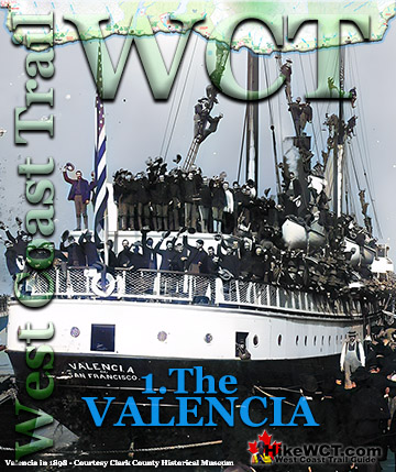
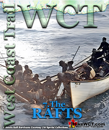
The Valencia Disaster
Explore BC Hiking Destinations!
The West Coast Trail
Victoria Hiking Trails
Clayoquot Hiking Trails
Whistler Hiking Trails
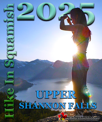
Squamish Hiking Trails

Vancouver Hiking Trails