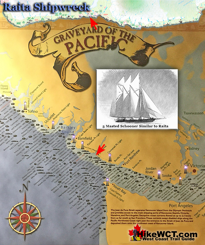
![]() The Raita shipwreck is located off the reefs at about the 33 kilometre mark of the West Coast Trail. Located just offshore and most remnants of this wreck are hidden under the waves. Some of the hull timbers can still be seen by the determined, just down from the river bed near Whyac Point. This section of the West Coast Trail is quite far inland, away from the coast, so you won't likely even get to look over the sea where she met her end.
The Raita shipwreck is located off the reefs at about the 33 kilometre mark of the West Coast Trail. Located just offshore and most remnants of this wreck are hidden under the waves. Some of the hull timbers can still be seen by the determined, just down from the river bed near Whyac Point. This section of the West Coast Trail is quite far inland, away from the coast, so you won't likely even get to look over the sea where she met her end.
 Alaskan Shipwreck at 4km
- Soquel Shipwreck at 5km
- Sarah Shipwreck at 7km
- Becherdass-Ambiadass Shipwreck at 8km
- Michigan Shipwreck at 12km
- Uzbekistan Shipwreck at 13.8km
- Varsity Shipwreck at 17.6km
- Valencia Shipwreck at 18.3km
- Janet Cowan Shipwreck at 19km
- Robert Lewers Shipwreck at 20km
- Woodside Shipwreck at 20.2km
- Uncle John Shipwreck at 26.2km
- Vesta Shipwreck at 29km
- Raita Shipwreck at 33km
- Skagit Shipwreck at 34.2km
- Santa Rita Shipwreck at 37km
- Dare Shipwreck at 39km
- Lizzie Marshall Shipwreck at 47km
- Puritan Shipwreck at 48.5km
- Wempe Brothers Shipwreck at 49.4km
- Duchess of Argyle Shipwreck at 58km
- John Marshall Shipwreck at 62.3km
- William Tell Shipwreck at 64.2km
- Revere Shipwreck at 69km
- Cyrus Shipwreck at 75km
The Raita is just off the rocks near Whyac Point. Whyac Point is just down from the Nitinaht Narrows ferry crossing on the West Coast Trail. The Raita was a 3 masted schooner of 309 tons, built in California in 1890(originally the Raita was named Lucy). The Raita was a French registered ship of of Papete, French Polynesia. She was loaded with lumber from Port Gamble, Washington heading to deliver it to Tahiti. Shortly after setting sail, she began taking on water. The strong winds and current overpowered the Raita and she was forced perilously close to Vancouver Island. In a desperate attempt to regain control, the crew began dumping their cargo into the sea and dropped her anchor. The winds picked up and snapped the anchor chain. The crew seeing the rocky shoreline coming near, launched a lifeboat and escaped. They managed to row safely to the Carmanah Lighthouse and were soon picked up by a passing CPR steamship. The Raita was bashed into the shore at Whyac Point, which at the time was known as Mission Point. At low tide she was high and dry on the rocks, completely out of the water. She was wrecked here on January 18th, 1925. Some of the old ship's hull timbers can still be seen today, a century later!

More Shipwrecks Near the Raita (KM33)
The Uncle John Shipwreck Near KM26
![]() The Raita shipwreck is in a part of the Graveyard of the Pacific dotted with shipwrecks. The Skagit met its end out from the 34.2km mark of the West Coast Trail. The Santa Rita at 37km. And in the other direction the Uncle John at 26.2km and the Vesta at 29km. The Uncle John was a 138 foot, three masted barkentine of 314 tons. Built in Eureka, California in 1881 and wrecked one kilometre east of Tsusiat Falls on the West Coast Trail. She was inbound in ballast from Hololulu, heading to Port Townsend. Owing to awful weather and heavy seas, the crew was unable to obtain any sights. Upon hearing breakers, she slowed and drifted into "an immense flat rock", which the ship became lodged against. Unable to launch a boat, the crew was forced to spend the night on the unmovable ship. When daylight finally arrived, the crew was able to make their escape to shore. The Uncle John continued to get pounded against the rock shelf until she was breaking apart. Her final resting place on the Graveyard of the Pacific is just down the beach from Hole In the Wall on the West Coast Trail.
The Raita shipwreck is in a part of the Graveyard of the Pacific dotted with shipwrecks. The Skagit met its end out from the 34.2km mark of the West Coast Trail. The Santa Rita at 37km. And in the other direction the Uncle John at 26.2km and the Vesta at 29km. The Uncle John was a 138 foot, three masted barkentine of 314 tons. Built in Eureka, California in 1881 and wrecked one kilometre east of Tsusiat Falls on the West Coast Trail. She was inbound in ballast from Hololulu, heading to Port Townsend. Owing to awful weather and heavy seas, the crew was unable to obtain any sights. Upon hearing breakers, she slowed and drifted into "an immense flat rock", which the ship became lodged against. Unable to launch a boat, the crew was forced to spend the night on the unmovable ship. When daylight finally arrived, the crew was able to make their escape to shore. The Uncle John continued to get pounded against the rock shelf until she was breaking apart. Her final resting place on the Graveyard of the Pacific is just down the beach from Hole In the Wall on the West Coast Trail.
Uncle John shipwreck continued here...
The Vesta Shipwreck Near KM29
![]() At about 29 kilometres on the West Coast Trail you will pass the Vesta shipwreck. This 3 masted schooner of 286 tons was wrecked here on November 10th, 1897. This 128 foot long sailing ship was primarily used to ship lumber to California. The Vesta was inbound from California in ballast to Port Blakely Mills on Bainbridge Island, Washington. The Vesta wrecked at 430am on the 10th of November and was carried so high on the beach as to find her masts in the trees. She had overrun her position due to stormy, foggy weather and the unaccounted for current that brought so many ships to a tragic end in the Graveyard of the Pacific. All of the Vesta's crew of 8 men survived and were able to row to safety and rescue once the storm eased enough to safely travel. The Vesta, owing to its resting place high on the beach, remained there for several years. Often used by lineman seeking shelter, she was often noted by passing ships and used as a landmark. Eventually the hulk was burned in order to salvage the metal fastenings. Some metal parts of the Vesta can still be found today on the spot where she rested for so long. One of her anchors still lies buried in the sand and revealed occasionally by winter storms.
At about 29 kilometres on the West Coast Trail you will pass the Vesta shipwreck. This 3 masted schooner of 286 tons was wrecked here on November 10th, 1897. This 128 foot long sailing ship was primarily used to ship lumber to California. The Vesta was inbound from California in ballast to Port Blakely Mills on Bainbridge Island, Washington. The Vesta wrecked at 430am on the 10th of November and was carried so high on the beach as to find her masts in the trees. She had overrun her position due to stormy, foggy weather and the unaccounted for current that brought so many ships to a tragic end in the Graveyard of the Pacific. All of the Vesta's crew of 8 men survived and were able to row to safety and rescue once the storm eased enough to safely travel. The Vesta, owing to its resting place high on the beach, remained there for several years. Often used by lineman seeking shelter, she was often noted by passing ships and used as a landmark. Eventually the hulk was burned in order to salvage the metal fastenings. Some metal parts of the Vesta can still be found today on the spot where she rested for so long. One of her anchors still lies buried in the sand and revealed occasionally by winter storms.
Vesta shipwreck continued here...
The Skagit Shipwreck Near KM34
![]() The Skagit, a 3 masted barkentine of 506 tons was wrecked on the reef in front of Clo-oose on what is now the West Coast Trail. This 156 foot ship was built in Port Ludlow, Washington in 1883 and was primarily used to ship lumber down the coast to San Francisco. The Skagit was sailing in from San Francisco in ballast to Port Gamble, Washington to load lumber. The crew ran into a storm and massively misread her position. The crew sighted the light at Cape Flattery and believed it to be the light from the Umatilla lighthouse. The storm drove her on to the reef at 4am on October 25th, 1906. The impact of the ship hitting the rocks was so powerful that it killed the captain and cook. The remaining 8 crew members escaped by scrambling over the bow at daybreak and clawing their way to shore. They found help and shelter at Clo-oose and later brought down to Victoria. Today you will almost trip over one of the Skagit's anchors where it lays on the beach in the same spot as it has for a century. You will see it just past the Nitinaht Narrows ferry crossing, after you hike through the forest and emerge on the beach. The adventurous and determined may be able to find more remnants of the Skagit down at the foot of the reef, just below the low tide level.
The Skagit, a 3 masted barkentine of 506 tons was wrecked on the reef in front of Clo-oose on what is now the West Coast Trail. This 156 foot ship was built in Port Ludlow, Washington in 1883 and was primarily used to ship lumber down the coast to San Francisco. The Skagit was sailing in from San Francisco in ballast to Port Gamble, Washington to load lumber. The crew ran into a storm and massively misread her position. The crew sighted the light at Cape Flattery and believed it to be the light from the Umatilla lighthouse. The storm drove her on to the reef at 4am on October 25th, 1906. The impact of the ship hitting the rocks was so powerful that it killed the captain and cook. The remaining 8 crew members escaped by scrambling over the bow at daybreak and clawing their way to shore. They found help and shelter at Clo-oose and later brought down to Victoria. Today you will almost trip over one of the Skagit's anchors where it lays on the beach in the same spot as it has for a century. You will see it just past the Nitinaht Narrows ferry crossing, after you hike through the forest and emerge on the beach. The adventurous and determined may be able to find more remnants of the Skagit down at the foot of the reef, just below the low tide level.
Skagit shipwreck continued here...
The Santa Rita Shipwreck Near KM37
![]() Near the 37 kilometre mark on the West Coast Trail you will pass the Santa Rita, a 100 year old shipwreck hidden under the waves. The Santa Rita was a steel steam schooner, built in San Francisco in 1913. On February 15th, 1923 at 520am, this 235 foot long, 1600 ton ship collided head on with the the small island reef just a few hundred metres from the beach. The Santa Rita was sailing in from San Pedro, California, in ballast for a port in the Puget Sound. In stormy weather and blindly navigating in poor visibility, the Carmanah Point Lighthouse was mistaken for the Cape Flattery Lighthouse on Tatoosh Island. The Carmanah Point Lighthouse is along the West Coast Trail and the Cape Flattery Lighthouse is 24.5 kilometres across Juan de Fuca Strait in the United States! The crew turned into what they thought was Juan de Fuca Strait and keeping the Cape Flattery Lighthouse on their right. Unfortunately they were about 20 kilometres north of what they thought, and were in fact keeping the Carmanah Point Lighthouse to their right and sailing directly at Vancouver Island. At 520am on February 15th, 1923 the Santa Rita collided head on into a small offshore reef just a few hundred metres from the West Coast Trail. The large ship, must have been sailing at quite a speed owing to the crew's reckoning that they were entering Juan de Fuca Strait. The sudden impact must have been horrific, loud, and completely unwarned. In the next few hours the entire crew of 30 escaped the wreck via breeches buoy. A breeches buoy is a rope based rescue system where a line runs from the ship to the shore and survivors ride in a flotation ring and leg harness.
Near the 37 kilometre mark on the West Coast Trail you will pass the Santa Rita, a 100 year old shipwreck hidden under the waves. The Santa Rita was a steel steam schooner, built in San Francisco in 1913. On February 15th, 1923 at 520am, this 235 foot long, 1600 ton ship collided head on with the the small island reef just a few hundred metres from the beach. The Santa Rita was sailing in from San Pedro, California, in ballast for a port in the Puget Sound. In stormy weather and blindly navigating in poor visibility, the Carmanah Point Lighthouse was mistaken for the Cape Flattery Lighthouse on Tatoosh Island. The Carmanah Point Lighthouse is along the West Coast Trail and the Cape Flattery Lighthouse is 24.5 kilometres across Juan de Fuca Strait in the United States! The crew turned into what they thought was Juan de Fuca Strait and keeping the Cape Flattery Lighthouse on their right. Unfortunately they were about 20 kilometres north of what they thought, and were in fact keeping the Carmanah Point Lighthouse to their right and sailing directly at Vancouver Island. At 520am on February 15th, 1923 the Santa Rita collided head on into a small offshore reef just a few hundred metres from the West Coast Trail. The large ship, must have been sailing at quite a speed owing to the crew's reckoning that they were entering Juan de Fuca Strait. The sudden impact must have been horrific, loud, and completely unwarned. In the next few hours the entire crew of 30 escaped the wreck via breeches buoy. A breeches buoy is a rope based rescue system where a line runs from the ship to the shore and survivors ride in a flotation ring and leg harness.
Santa Rita shipwreck continued here...
Campsites Near the Raita (KM33)
Cribs Creek Campsite at 42km
![]() The closest campsite to the Raita is Cribs Creek, at kilometre 42. Cribs Creek is not a terribly nice campsite. The beach is a bit ugly, the creek is not terribly impressive compared a few others you will encounter on the West Coast Trail or deep enough for a swim. Also, it tends to be very busy owing to its distance from other campsites. The Raita wrecked fairly close to Tsusiat Point on the West Coast Trail. Tsusiat Point is the wonderfully photogenic rock formation known as Hole In the Wall. A large cliff of rock that juts out into the sea with a huge opening where most West Coast Trail hikers find themselves passing through on their journey. Tsusiat Falls campsite is just down the beach from the Vesta shipwreck site. One of the most popular and beautiful campsites along the West Coast Trail . Tsusiat Falls is one of the main highlights on the trail with its dramatically wide and beautifully picturesque appearance.
The closest campsite to the Raita is Cribs Creek, at kilometre 42. Cribs Creek is not a terribly nice campsite. The beach is a bit ugly, the creek is not terribly impressive compared a few others you will encounter on the West Coast Trail or deep enough for a swim. Also, it tends to be very busy owing to its distance from other campsites. The Raita wrecked fairly close to Tsusiat Point on the West Coast Trail. Tsusiat Point is the wonderfully photogenic rock formation known as Hole In the Wall. A large cliff of rock that juts out into the sea with a huge opening where most West Coast Trail hikers find themselves passing through on their journey. Tsusiat Falls campsite is just down the beach from the Vesta shipwreck site. One of the most popular and beautiful campsites along the West Coast Trail . Tsusiat Falls is one of the main highlights on the trail with its dramatically wide and beautifully picturesque appearance.


Cribs Creek campsite continued here...
Carmanah Creek Campsite at 46km
![]() Just 4 kilometres from Cribs Creek is the very beautiful Carmanah Creek campsite. Carmanah Creek slowly flows through this wonderfully massive channel that cuts deep into the sand out to the ocean. There is a cable car crossing that connects to the forest on either side of the creek. Most West Coast Trail hikers pass the campsite here without taking a moment to look at the nice beach. Plenty of room for plenty of tents on the wide, sand beach. This is one of the beaches that makes you drop your pack, sit on the warm sand and gaze out at the ocean dumbfounded for minutes at a time. The West Coast Trail is something special! There is no shortage of great spots on the beach to put up your tent. You can even put up your tent along the river on the lovely sandy/rocky bank. Everybody camps at the unimpressive Cribs Creek campsite just 4 kilometres away, leaving Carmanah Creek a serene little hideaway. This is one of the campsites where you will want to stay for days, so you might want to include that in your itinerary! There are the usual West Coast Trail campsite amenities at Carmanah Creek, including some clearings in the forest for tents. The beach is ideal for camping, and on a sunny day, you will find yourself wandering down the lovely beach towards the Carmanah Lighthouse. Chez Monique's is along the beach between the lighthouse and Carmanah Creek. There you will find a restaurant along the beach with burgers and drinks. Seems a bit strange to encounter a restaurant in the middle of the West Coast Trail, but it has been here for years and will likely remain. For some, Chez Monique's is a highlight of the trail, for others it is an annoying bit of civilisation in the midst of the wild beauty of the west coast of Vancouver Island.
Just 4 kilometres from Cribs Creek is the very beautiful Carmanah Creek campsite. Carmanah Creek slowly flows through this wonderfully massive channel that cuts deep into the sand out to the ocean. There is a cable car crossing that connects to the forest on either side of the creek. Most West Coast Trail hikers pass the campsite here without taking a moment to look at the nice beach. Plenty of room for plenty of tents on the wide, sand beach. This is one of the beaches that makes you drop your pack, sit on the warm sand and gaze out at the ocean dumbfounded for minutes at a time. The West Coast Trail is something special! There is no shortage of great spots on the beach to put up your tent. You can even put up your tent along the river on the lovely sandy/rocky bank. Everybody camps at the unimpressive Cribs Creek campsite just 4 kilometres away, leaving Carmanah Creek a serene little hideaway. This is one of the campsites where you will want to stay for days, so you might want to include that in your itinerary! There are the usual West Coast Trail campsite amenities at Carmanah Creek, including some clearings in the forest for tents. The beach is ideal for camping, and on a sunny day, you will find yourself wandering down the lovely beach towards the Carmanah Lighthouse. Chez Monique's is along the beach between the lighthouse and Carmanah Creek. There you will find a restaurant along the beach with burgers and drinks. Seems a bit strange to encounter a restaurant in the middle of the West Coast Trail, but it has been here for years and will likely remain. For some, Chez Monique's is a highlight of the trail, for others it is an annoying bit of civilisation in the midst of the wild beauty of the west coast of Vancouver Island.


Carmanah Creek campsite continued here...
Tsusiat Falls Campsite at 25km
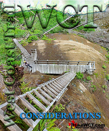
![]() One of the most popular and beautiful campsites along the West Coast Trail is Tsusiat Falls. It is one of the main highlights on the trail with its dramatically wide and beautifully picturesque appearance. You will find Tsusiat Falls at the base of an extraordinary array of ladders extending hundreds of metres up into the trees. Tsusiat Falls pours over an abrupt and wide cliff onto the sandy beach. The force of the water has dug out quite a large pool that flows in an ever changing channel through the sand to the ocean. It is quite common to see whales passing in the distance from the beach at Tsusiat. The beach is raised up a few metres from the ocean and affords you a better vantage point over the ocean than you get elsewhere. Tsusiat Falls campsite is wide and extends as far as you want to go down the beach. As everyone has seen pictures of it, everyone aims for it to spend the night. If you don't mind crowds then you'll love it. If you don't like crowds, you may have trouble finding a serene corner to camp. If you really want to find serenity, you might try camping at the far end of the beach where you will find quite a large sea cave. If you love waking up to whales in the distance and the beautiful roar of waterfalls nearby, then you will find that at Tsusiat. The campsite is well designed for crowds though as the hundreds of driftwood logs on the beach have fashioned partitioned areas randomly, where some sort of organized privacy exists.
One of the most popular and beautiful campsites along the West Coast Trail is Tsusiat Falls. It is one of the main highlights on the trail with its dramatically wide and beautifully picturesque appearance. You will find Tsusiat Falls at the base of an extraordinary array of ladders extending hundreds of metres up into the trees. Tsusiat Falls pours over an abrupt and wide cliff onto the sandy beach. The force of the water has dug out quite a large pool that flows in an ever changing channel through the sand to the ocean. It is quite common to see whales passing in the distance from the beach at Tsusiat. The beach is raised up a few metres from the ocean and affords you a better vantage point over the ocean than you get elsewhere. Tsusiat Falls campsite is wide and extends as far as you want to go down the beach. As everyone has seen pictures of it, everyone aims for it to spend the night. If you don't mind crowds then you'll love it. If you don't like crowds, you may have trouble finding a serene corner to camp. If you really want to find serenity, you might try camping at the far end of the beach where you will find quite a large sea cave. If you love waking up to whales in the distance and the beautiful roar of waterfalls nearby, then you will find that at Tsusiat. The campsite is well designed for crowds though as the hundreds of driftwood logs on the beach have fashioned partitioned areas randomly, where some sort of organized privacy exists.


Tsusiat Falls campsite continued here...
West Coast Trail A to Z
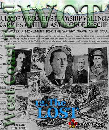
The Valencia Shipwreck Disaster


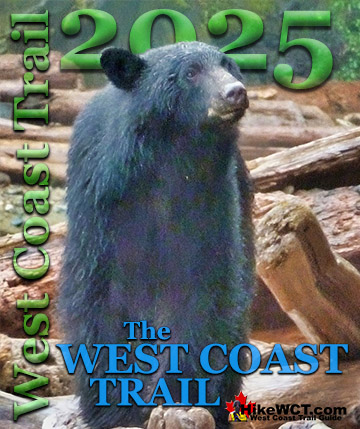
West Coast Trail Guide

Explore BC Hiking Destinations!
The West Coast Trail
Victoria Hiking Trails
Clayoquot Hiking Trails
Whistler Hiking Trails
Squamish Hiking Trails

Vancouver Hiking Trails