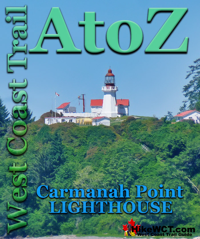
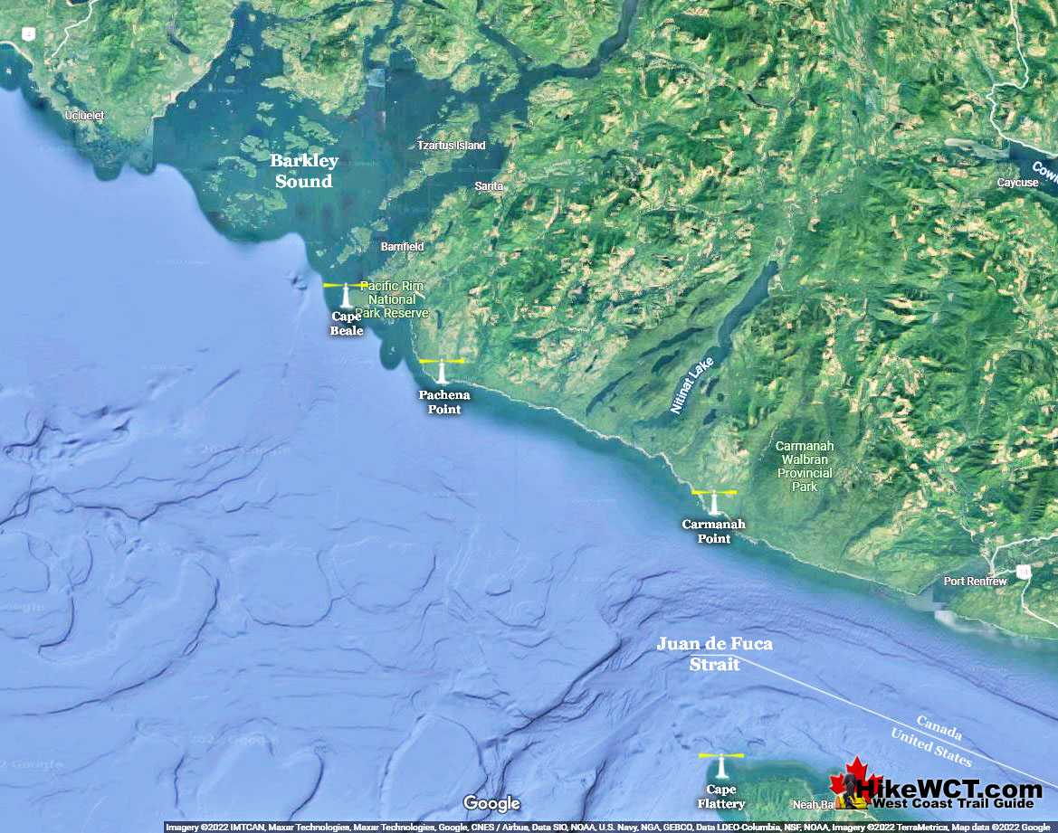
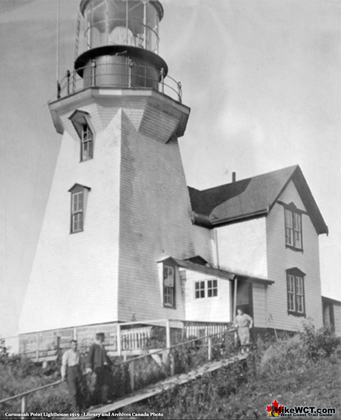
![]() Carmanah Point Lighthouse is located near the 44km mark of the West Coast Trail. It guards the entrance to Juan de Fuca Strait opposite the Cape Flattery Lighthouse 24.5km across the strait in the United States. Operational in 1891, the original structure was built out of wood. In 1920 the tower was rebuilt out of concrete and this is the one we see today.
Carmanah Point Lighthouse is located near the 44km mark of the West Coast Trail. It guards the entrance to Juan de Fuca Strait opposite the Cape Flattery Lighthouse 24.5km across the strait in the United States. Operational in 1891, the original structure was built out of wood. In 1920 the tower was rebuilt out of concrete and this is the one we see today.
West Coast Trail Shipwrecks
![]() Alaskan at 4k
Alaskan at 4k ![]() Soquel at 5k
Soquel at 5k ![]() Sarah at 7k
Sarah at 7k ![]() Becherdass-Ambiadass at 8k
Becherdass-Ambiadass at 8k ![]() Michigan at 12k
Michigan at 12k ![]() Uzbekistan at 13.8k
Uzbekistan at 13.8k ![]() Varsity at 17.6k
Varsity at 17.6k ![]() Valencia at 18.3k
Valencia at 18.3k ![]() Janet Cowan at 19k
Janet Cowan at 19k ![]() Robert Lewers at 20k
Robert Lewers at 20k ![]() Woodside at 20.2k
Woodside at 20.2k ![]() Uncle John at 26.2k
Uncle John at 26.2k ![]() Vesta at 29k
Vesta at 29k ![]() Raita at 33k
Raita at 33k ![]() Skagit at 34.2k
Skagit at 34.2k ![]() Santa Rita at 37k
Santa Rita at 37k ![]() Dare at 39k
Dare at 39k ![]() Lizzie Marshall at 47k
Lizzie Marshall at 47k ![]() Puritan at 48.5k
Puritan at 48.5k ![]() Wempe Brothers at 49.4k
Wempe Brothers at 49.4k ![]() Duchess of Argyle at 58k
Duchess of Argyle at 58k ![]() John Marshall at 62.3k
John Marshall at 62.3k ![]() William Tell at 64.2
William Tell at 64.2 ![]() Revere at 69k
Revere at 69k ![]() Cyrus at 75k
Cyrus at 75k
West Coast Trail Campsites
![]() Pachena Bay Campground
Pachena Bay Campground ![]() Michigan Creek at 12k
Michigan Creek at 12k ![]() Darling River at 14k
Darling River at 14k ![]() Orange Juice Creek at 15k
Orange Juice Creek at 15k ![]() Tsocowis Creek at 16.5k
Tsocowis Creek at 16.5k ![]() Klanawa River at 23k
Klanawa River at 23k ![]() Tsusiat Falls at 25k
Tsusiat Falls at 25k ![]() Cribs Creek at 42k
Cribs Creek at 42k ![]() Carmanah Creek at 46k
Carmanah Creek at 46k ![]() Bonilla Creek at 48k
Bonilla Creek at 48k ![]() Walbran Creek at 53k
Walbran Creek at 53k ![]() Cullite Cove at 58k
Cullite Cove at 58k ![]() Camper Bay at 62k
Camper Bay at 62k ![]() Thrasher Cove at 70k
Thrasher Cove at 70k ![]() Pacheedaht Campground
Pacheedaht Campground
If you look on a map the Carmanah Point Lighthouse is not that far from Victoria at 100km and Port Renfrew is just 25km away. Despite this relative closeness, Carmanah Point was for decades the most inaccessible lighthouse along the British Columbia coast. No roads or trails existed to it and boats were often unable to be launched to reach the supply ship waiting offshore in stormy seas. Several weeks passed between supply drops during the stormy winter months and fresh fruit, vegetables, meat and other essentials had to be hauled in through brutal rainforest trails from Clo-oose. It was not unusual to have freight dropped off in Port Renfrew when winter storms prevented safe landing at Clo-oose. When storms subsided local First Nations people were hired to bring it in by canoe. The unreliable supply drops were only one of many challenges faced by the early Carmanah Point Lighthouse keepers. Machinery often broke causing the lighthouse keeper to manually operate instruments through the night. Coal to fuel the lighthouse was often poor quality and required the lighthouse keeper to have to laboriously clean the lenses. On top of all that there were frequent shipwrecks near the lighthouse requiring the overworked lighthouse keeper and his family to rush to their aid.
Planning and Construction Begins
Near the same time the Cape Flattery Lighthouse was built in 1857 Admiralty Surveyor Captain G.H. Richards pointed to the need for another lighthouse on the opposite side of Juan de Fuca Strait, on Vancouver Island on Bonilla Point. Decades would pass and several ships and lives lost before the Canadian government would go ahead with building it in 1890. The motivating factor in the decision was not safety, but rather inconvenience at ships often needing to wait outside the strait for days for fog to clear to enter safely.
Carmanah Point Mistaken for Bonilla Point
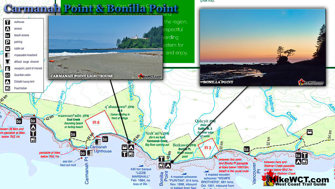
A new lighthouse would help shorten that delay considerably and Bonilla Point was chosen as the new location. Supplies were shipped in and landed on the shore and laboriously hauled up to the construction site. As construction was to begin it was realized that they had mistakenly brought everything to Carmanah Point, just a couple kilometres west of Bonilla Point. Unwilling to correct their mistake they decided to build where they were. Bonilla Point had been chosen for a reason that the construction crew may have been unaware. Bonilla Point extends out further into the strait than Carmanah Point does. Because of this Bonilla Point has an unobstructed view in both directions along the coast of Vancouver Island. Carmanah Point has Bonilla Point blocking its view westward down the coast toward Port Renfrew. Not only is the view of the Carmanah Point Lighthouse obscured, but ships coming out of Juan de Fuca Strait will not be able to see the light at certain angles.
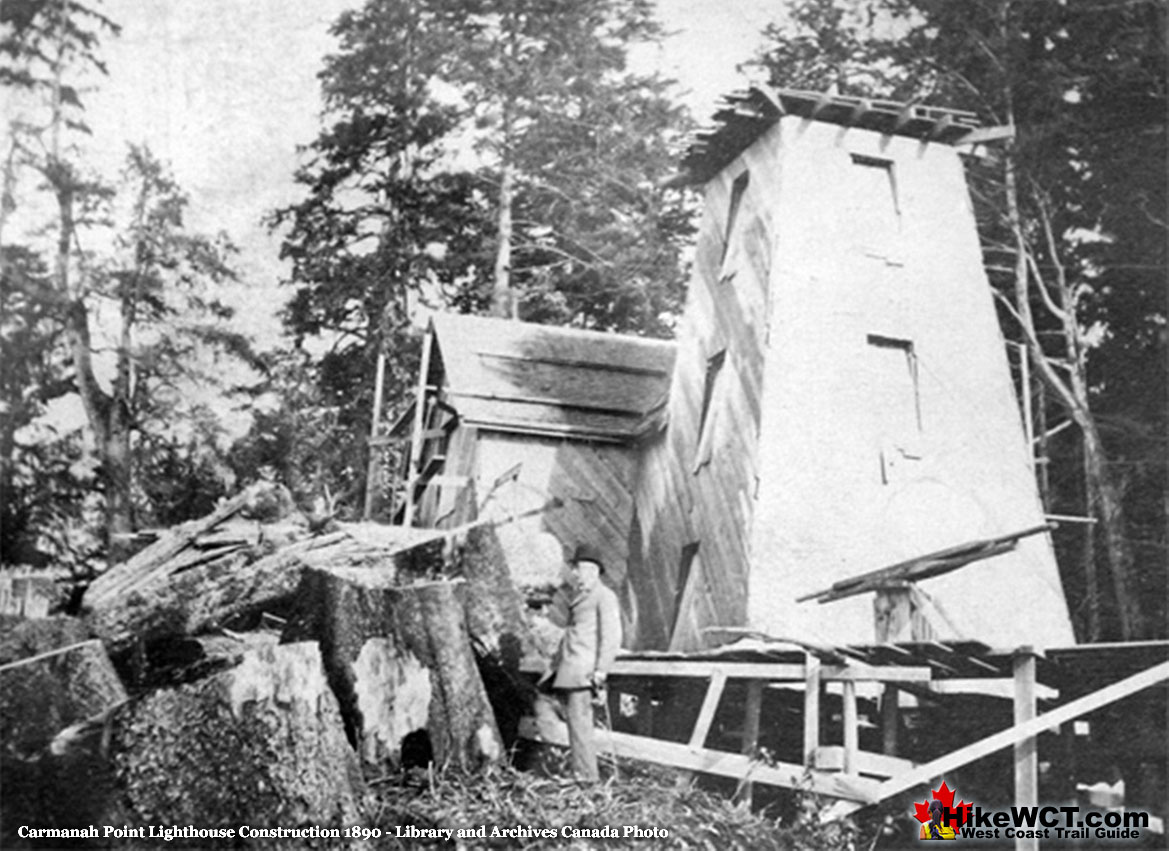
Carmanah Point Lighthouse Operational
When completed the wooden tower was 14 metres tall with an attached house. The light was visible for 30 kilometres (19 miles) at night if the weather was clear. The new lighthouse was also capable of communicating with incoming and outgoing vessels with the use of a steam whistle and morse code. The lighthouse keeper was tasked with reporting vessels in and out of Juan de Fuca Strait by telegraph to Victoria. The new lighthouse was also stocked with food and supplies to aid shipwreck survivors.
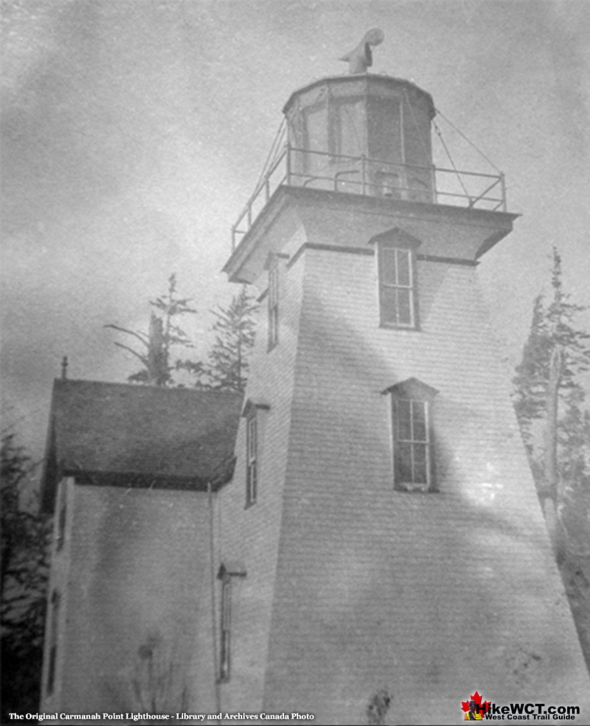
Carmanah Point's First Lighthouse Keeper
The first lighthouse keeper was Phil Daykin, his wife, five sons and his mother. He wrote a daily journal in great detail about all the events of the day and the nine volumes are now at the Royal BC Museum in Victoria. The nine volumes are a rare look at the daily events that happened for over twenty years along this wild and barely documented coast. Without these journals we likely would not know how challenging life was maintaining such a remote lighthouse on such a weather battered coast.
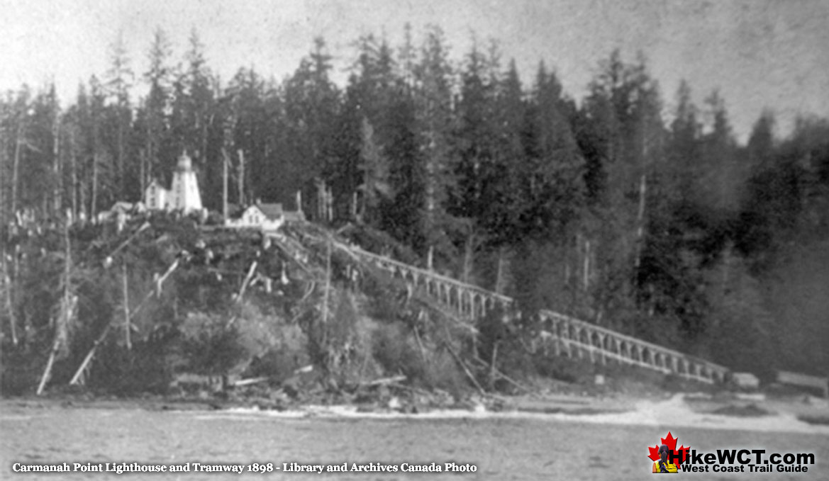
Carmanah Point Lighthouse Journals by Daykin
The journals are at times heartbreaking as the constant struggle to keep the lighthouse functioning were staggering. Daykin frequently pleaded for assistance from Victoria and was almost always denied. In a stark contrast to modern times he was neglected and abused by his superiors. In 1903, after receiving yet another application from Daykin for a transfer, his boss actually threatened, “Stay where you are, of face a cut in pay.” After 21 years of brutal work and numerous denials of transfers to less onerous lighthouses, his health declined so much that he was finally moved to a lighthouse in Victoria.
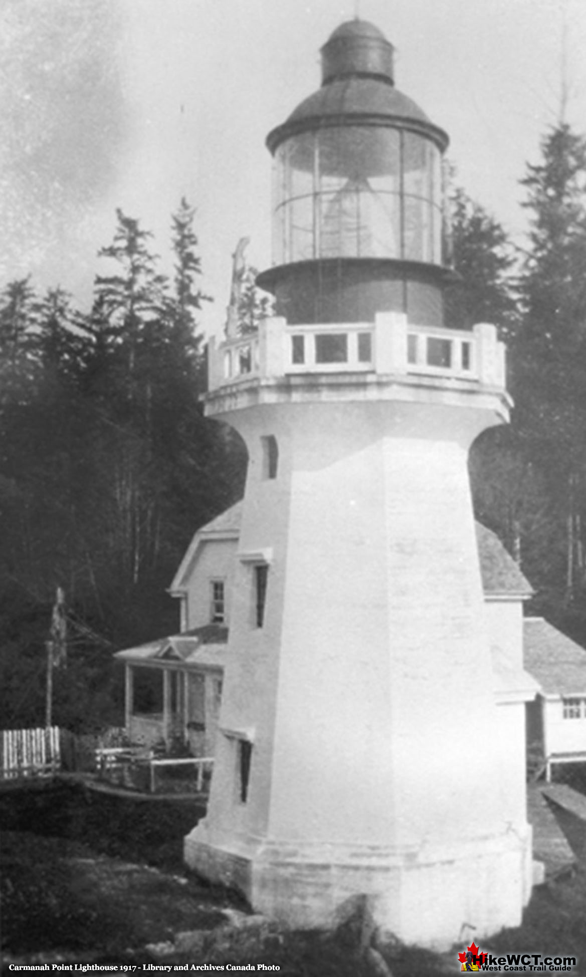
As if to validate his years of complaining, his replacement lasted just a few days before being overwhelmed by the workload and quitting in disgust. One of Daykin’s sons, Robert Daykin stepped in and worked the lighthouse from 1912 to 1917. Several lighthouse keepers followed Robert Daykin and most managed to stay a comparatively short time. It wasn’t until a helicopter pad was built that Carmanah Point Lighthouse was reliably supplied year-round.
Carmanah Point Lighthouse in Print
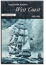
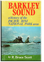 Vancouver Island’s West Coast 1762-1962 by George Nicholson is a fantastic history that gives you a window to a staggering array of events that occurred during those two eventful centuries. The amount of research that went into this book must have been colossal. Dozens and dozens of beautiful illustrations bring the people and places to life. Published in 1965 after decades of living in the area, Nicholson is able to write about events he was part of. Other events that happened before his time, he is able to describe in detail only possible by living in the area and knowing every feature of the land. His sources are from the written journals of the many explorers in the area. All the other well-known West Coast Trail shipwrecks are mentioned in one chapter titled, “Forty Wrecks, One for Every Mile”. Tsusiat Falls has a chapter devoted to it as well as Carmanah Point Lighthouse and Cape Flattery Lighthouse. Vancouver Island’s West Coast 1762-1962 can be found online on Amazon and many other online book stores. Vancouver Island’s West Coast 1762-1962 continued here... R. Bruce Scott's second book, Barkley Sound A History of the Pacific Rim National Park Area is yet another incredible book by Scott and the second in his trilogy of books on the history of the west coast of Vancouver Island. This amazing book published in 1972 has a chapter on Pacific Rim National Park, a few chapters on some of the first European explorers. He then has chapters covering some of the trading posts and early settlements along the islands west coast. He has an interesting chapter on the Cape Beale Lighthouse, Carmanah Point Lighthouse and Pachena Point Lighthouse. Barkley Sound A History of Pacific Rim Park continued here...
More West Coast Trail Glossary A to Z
West Coast Trail A to Z
The West Coast Trail by Day
Explore BC Hiking Destinations!
The West Coast Trail
Victoria Hiking Trails
Clayoquot Hiking Trails
Whistler Hiking Trails
Squamish Hiking Trails

Vancouver Hiking Trails

