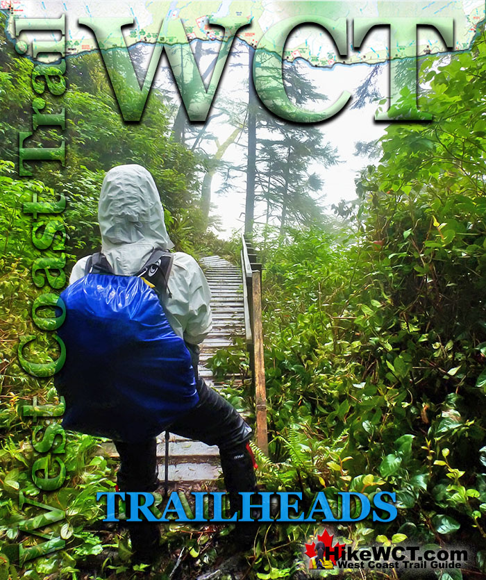
![]() There are three entry/exit points for the West Coast Trail, however the midway entry/exit point at Nitinaht Narrows is for hikers only hiking part of the trail. The two main entry points are at Pachena Bay in the north(Bamfield) and Gordon River in the south(Port Renfrew). Port Renfrew is located a 2 hours drive from Victoria and Bamfield is quite a bit further and more challenging to get to and find.
There are three entry/exit points for the West Coast Trail, however the midway entry/exit point at Nitinaht Narrows is for hikers only hiking part of the trail. The two main entry points are at Pachena Bay in the north(Bamfield) and Gordon River in the south(Port Renfrew). Port Renfrew is located a 2 hours drive from Victoria and Bamfield is quite a bit further and more challenging to get to and find.
 Prologue
 Chapter 1: The West Coast Trail
 Chapter 2: When to Hike & Fees
 Chapter 3: Trailheads
 Chapter 4: Getting There
 Chapter 5: Considerations
 Chapter 6: Campsites
 Chapter 7: Shipwrecks
 Chapter 8: Routes
 Chapter 9: Sights & Highlights
If you are coming from the Nanaimo ferry terminal, the driving time to the Pachena Bay trailhead near Bamfield takes 3.5 hours. The stretch of terrible logging road from Port Alberni alone takes 2 hours! When you consider where to start and finish the West Coast Trail, transportation practicalities should be high on your list of importance. The Pachena Bay trailhead is far more remote and challenging to get to than the Gordon River trailhead.
The Gordon River trailhead is extremely easy to find from Victoria. Simply drive out of the city following the highway signs to Sooke and/or Port Renfrew. In two hours you will arrive at the very small town of Port Renfrew and quickly spot signs to the West Coast Trail. None of this route is on gravel roads and almost the entire drive is scenic and interesting.
If you are taking one of the BC Ferries over from Vancouver you have three options. You can sail from Tsawwassen ferry terminal(Vancouver) across to the Swartz Bay ferry terminal(Victoria). From Tsawwassen you can also take a ferry up to Departure Bay(Nanaimo). In North Vancouver you have another ferry terminal at Horseshoe Bay that takes you to Departure Bay(Nanaimo) as well.
BC Ferries get very busy in the summer months and growing demand has overwhelmed the Horseshoe Bay and Departure Bay ferry terminals. With the ferries being older and the infrastructure inadequate, you tend to get absurdly long waits that you don't tend to get a the Tsawwassen to Swartz Bay terminals. Departure Bay in Nanaimo is particularly bad as you regularly see two ferries come and go as you wait for a third. All the while the lineup is backed up well into the residential streets of Nanaimo!
If you are driving to the West Coast Trail, you have two options. Park at one end of the trail and take the West Coast Trail bus to the other end and hike back. Or you can hike from your car and bus back after finishing the trail. Taking the bus at the start of your hike seems like a better option as when you finish the trail you will be quite tired, hungry and not eager to wait for a bus to take you all the way back to your car. Parking for the West Coast Trail requires some careful consideration as well. Because locals know that a car parked will be unguarded for a week, there has been quite a shameful history of thefts from both trailheads.
The Pachena Bay trailhead in particular is bad. The solution is to park away from the trailheads at a pay parking lot where your vehicle is guarded. Port Renfrew has a very good one that even has roadside signs directing you there. The friendly owner will then drive you over to the trailhead and pick you up when you return in a week. It costs about $7-10 per day, which is quite a lot, but worth it for your peace of mind. The Pachena Bay trailhead is not so well serviced with guarded parking as there doesn't seem to be a reliable one available yet.
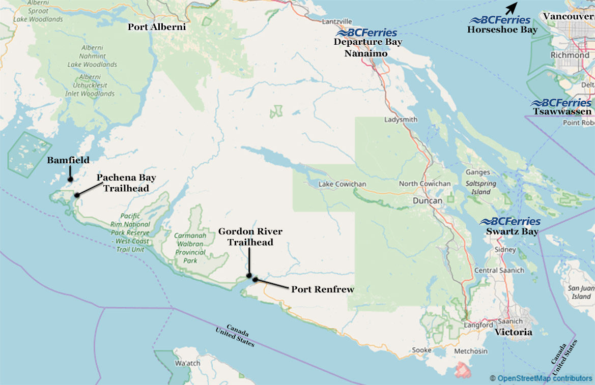
West Coast Trail Start and Finish
A recommended transportation itinerary would be to bus or drive from Victoria to Port Renfrew. Park at a pay lot and catch the West Coast Express bus up to Pachena Bay. Register and take your orientation seminar and then start the trail. In a week when you finish the trail you will be able to get to your car quickly and get on with your vacation. This itinerary has a lot of advantages. First, the drive or bus route from Victoria to Port Renfrew is beautiful and you have last minute shopping options on the way if you need. The road is entirely paved and very relaxing, whereas the road to Bamfield is along horrible logging roads and much longer. If you bus from Port Renfrew to the Pachena Bay trailhead you will not have to brutalize your own vehicle with the rough road. Bussing from Port Renfew to Pachena Bay is quite fun as well. You meet people excited about starting the trail and you will likely see them on the trail a few times. If you pick up something to eat for the bus ride you can have a nice meal before you start the trail. Bussing before you hike the West Coast Trail is far better than having the extra drive to your car at the end of the grueling hike.
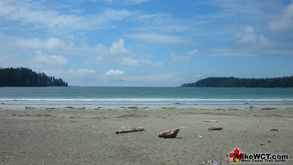
West Coast Trail Entry and Exit
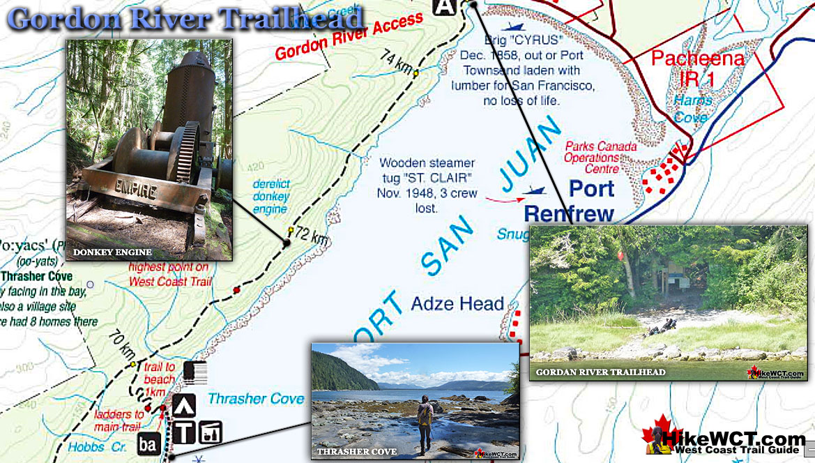
Starting the West Coast Trail from the north at Pachena Bay and parking at the south end in Port Renfrew has some good advantages over starting in the south and parking at the north. Parking is safer, the access road is scenic, paved and well directed. The north end of the trail is considerably easier than the south end, so you don't get overwhelmed with the trail at the start. You can ease into the trail with a few ladders, lots of great views and a relatively flat route to your first campsite. If you start from the south you will be hard hit with the difficulty of your first day and make slow progress. You will likely camp at Thrasher Cove, which is often very crowded and no fresh water for much of the summer. The cove is directly across from Port Renfrew so you have the feeling of not having hiked very far yet. If you started from the north you will emerge from the forest at 12k to your first campsite with no civilisation in sight and your first shipwreck visible from the beach!
Trailhead Campgrounds & Campsites on the West Coast Trail
![]() Pachena Bay Campground Near Trailhead
Pachena Bay Campground Near Trailhead ![]() Michigan Creek at 12k
Michigan Creek at 12k ![]() Darling River at 14k
Darling River at 14k ![]() Orange Juice Creek at 15k
Orange Juice Creek at 15k ![]() Tsocowis Creek at 16.5k
Tsocowis Creek at 16.5k ![]() Klanawa River at 23k
Klanawa River at 23k ![]() Tsusiat Falls at 25k
Tsusiat Falls at 25k ![]() Cribs Creek at 42k
Cribs Creek at 42k ![]() Carmanah Creek at 46k
Carmanah Creek at 46k ![]() Bonilla Creek at 48k
Bonilla Creek at 48k ![]() Walbran Creek at 53k
Walbran Creek at 53k ![]() Cullite Cove at 58k
Cullite Cove at 58k ![]() Camper Bay at 62k
Camper Bay at 62k ![]() Thrasher Cove at 70k
Thrasher Cove at 70k ![]() Pacheedaht Campground Near Trailhead
Pacheedaht Campground Near Trailhead
Differences in Difficulty Between WCT Trailheads
One consideration to keep in mind is the difficulty of the trail. From the north it gets progressively more challenging. Your pack should decrease in weight slightly everyday as you are going through your food. This should help offset the more difficult terrain a bit. If you start from the south end of the trail at the Gordon River trailhead you will find the trail gets a bit easier every day. This is a nice thought to keep in mind for purposes of morale. Another nice feature of hiking from the north is the fact that the kilometre markers start from the north so you can count them sequentially. From the south you will have to count down from 75k.
Good Campsites at Both WCT Trailheads
Both ends of the West Coast Trail have excellent, privately owned campsites near the trailheads. The Pachena Bay campground is the closest campsite to the Pachena trailhead, not on the West Coast Trail, but near the trailhead. Located on the far end of Pachena Beach, and about a 10 minute walk from the trailhead and the West Coast Trail registration building. Keep in mind that this is not on the West Coast Trail or affiliated with the WCT. Pachena Bay Campground is run by the Huu-ay-aht First Nations which resides nearby in the community of Anacla. The campsite is pretty good, but like most privately run, near-trailhead campsites, it is a bit crowded and very well used. It is also a bit expensive at $34 for a tent site, but you are getting a great location. Along with the location, the beach itself is terrific. Huge, sandy beach with a sweeping ocean view as well as the occasional bear visitor in the distance.
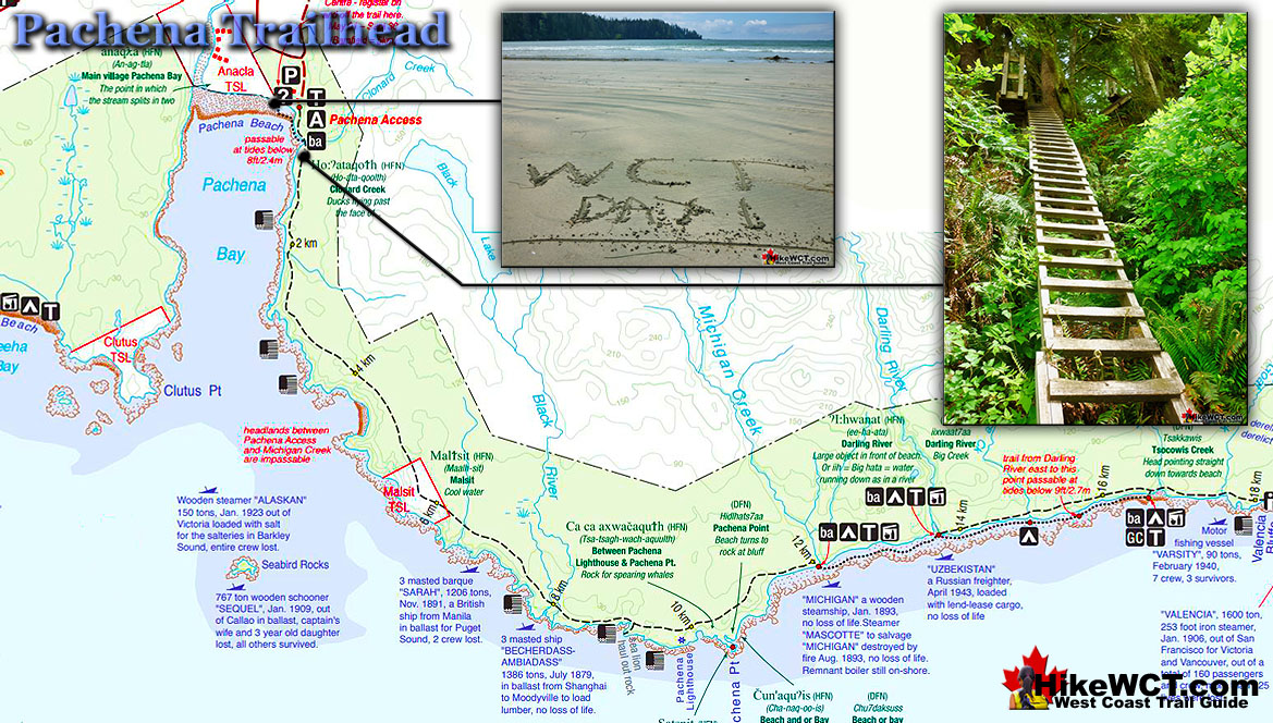
Pachena Bay stretches for 3 kilometres of beautiful, fine, beige sand. The beach is about 200 metres wide and somewhat similar to Long Beach in Pacific Rim National Park just a few kilometres north. Bamfield is just 3 kilometres down a gravel road and is a wonderful old fishing community that takes you back a few decades(in a good way). It is lovely, wild and very remote feeling. Many visitors to Pachena Bay are setting off on the West Coast Trail, however you will find some very nice, short, and free hiking trails nearby. These hikes are varied and each wonderful in their own right. Cape Beale Headlands, Keeha Beach, Kicha Lake and the trail to Bamfield all run through the centuries old rainforest in an unexpectedly wild and pristine setting. For big crashing waves and sweeping views of the Pacific, Cape Beale and Keeha Beach are impressive. Next: Getting There
West Coast Trail Guide

Explore BC Hiking Destinations!
The West Coast Trail

Victoria Hiking Trails

Clayoquot Hiking Trails

Whistler Hiking Trails

Squamish Hiking Trails

Vancouver Hiking Trails

